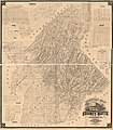
File:Map of Butte County, California, 1877, showing civil townships.jpg
Appearance

Size of this preview: 526 × 600 pixels. Other resolutions: 210 × 240 pixels | 421 × 480 pixels | 673 × 768 pixels | 898 × 1,024 pixels | 2,084 × 2,377 pixels.
Original file (2,084 × 2,377 pixels, file size: 1.07 MB, MIME type: image/jpeg)
File history
Click on a date/time to view the file as it appeared at that time.
| Date/Time | Thumbnail | Dimensions | User | Comment | |
|---|---|---|---|---|---|
| current | 00:02, 22 February 2023 |  | 2,084 × 2,377 (1.07 MB) | NapoliRoma | Uploaded a work by McGann, James Britton & Rey. from Library of Congress Geography and Map Division Washington, D.C. 20540-4650 USA dcu https://lccn.loc.gov/2012590105 with UploadWizard |
File usage
The following 2 pages use this file:
