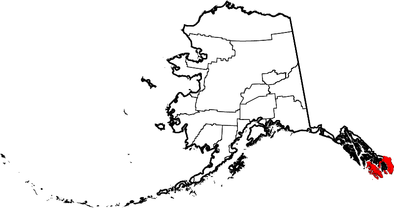
File:Map of Alaska highlighting Prince of Wales-Outer Ketchikan Census Area.svg
Appearance

Size of this PNG preview of this SVG file: 800 × 423 pixels. Other resolutions: 320 × 169 pixels | 640 × 338 pixels | 1,024 × 541 pixels | 1,280 × 677 pixels | 2,560 × 1,353 pixels | 1,470 × 777 pixels.
Original file (SVG file, nominally 1,470 × 777 pixels, file size: 644 KB)
File history
Click on a date/time to view the file as it appeared at that time.
| Date/Time | Thumbnail | Dimensions | User | Comment | |
|---|---|---|---|---|---|
| current | 20:13, 25 June 2024 |  | 1,470 × 777 (644 KB) | Nux | uniform colors with good contrast |
| 22:59, 17 June 2024 |  | 1,470 × 777 (338 KB) | Nux | fix rendering (remove clipping) | |
| 19:28, 5 March 2006 |  | 1,470 × 777 (338 KB) | David Benbennick | {{subst:User:Dbenbenn/clm|county=Prince of Wales-Outer Ketchikan Census Area|state=Alaska|type=borough and census area}} |
File usage
The following page uses this file:
Global file usage
The following other wikis use this file:
- Usage on bpy.wikipedia.org
- Usage on de.wikipedia.org
- Usage on es.wikipedia.org
- Usage on fr.wikipedia.org
- Usage on gl.wikipedia.org
- Usage on id.wikipedia.org
- Usage on ja.wikipedia.org
- Usage on nds.wikipedia.org
- Usage on nl.wikipedia.org
- Usage on no.wikipedia.org
- Usage on tr.wikipedia.org
- Usage on www.wikidata.org
- Usage on zh.wikipedia.org
