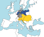
File:Map - Deutscher Bund 1820.png
Appearance
Map_-_Deutscher_Bund_1820.png (600 × 454 pixels, file size: 55 KB, MIME type: image/png)
File history
Click on a date/time to view the file as it appeared at that time.
| Date/Time | Thumbnail | Dimensions | User | Comment | |
|---|---|---|---|---|---|
| current | 22:05, 22 December 2006 |  | 600 × 454 (55 KB) | Electionworld | {{ew|en|52 Pickup}} == Summary == Map illustrating the borders of the German Confederation in 1820 == Licensing == {{PD-user|52 Pickup}} |
File usage
The following page uses this file:
Global file usage
The following other wikis use this file:
- Usage on ast.wikipedia.org
- Usage on eo.wikiquote.org
- Usage on fr.wikipedia.org
- Usage on gl.wikipedia.org
- Usage on hy.wikipedia.org
- Usage on nn.wikipedia.org
- Usage on no.wikipedia.org
- Usage on sr.wikipedia.org
- Usage on sw.wikipedia.org
- Usage on www.wikidata.org


