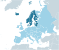
File:MapLab-Northern Europe.svg
Appearance

Size of this PNG preview of this SVG file: 713 × 600 pixels. Other resolutions: 285 × 240 pixels | 571 × 480 pixels | 913 × 768 pixels | 1,218 × 1,024 pixels | 2,435 × 2,048 pixels | 2,045 × 1,720 pixels.
Original file (SVG file, nominally 2,045 × 1,720 pixels, file size: 731 KB)
File history
Click on a date/time to view the file as it appeared at that time.
| Date/Time | Thumbnail | Dimensions | User | Comment | |
|---|---|---|---|---|---|
| current | 08:16, 8 November 2010 |  | 2,045 × 1,720 (731 KB) | Hayden120 | Added Åland, the Faroe Islands, and the Isle of Man. |
| 14:26, 7 November 2010 |  | 2,045 × 1,720 (731 KB) | The Emirr | Some countries has been added. | |
| 15:32, 31 October 2010 |  | 2,045 × 1,720 (731 KB) | The Emirr | The colors has been changed. | |
| 12:59, 30 October 2010 |  | 680 × 520 (533 KB) | The Emirr | {{Information |Description={{en|1=Map of Southern Europe.}} |Source={{own}} |Author={{click|image=TheEmirr-Logo.png|link=User:The Emirr|width=60px|height=60px}} {{click|image=Maplab-logo.svg|link=User:The Emirr/Maplab|width=60px|height=60px}} |Date=2010-1 |
File usage
The following page uses this file:
Global file usage
The following other wikis use this file:
- Usage on es.wikipedia.org
- Usage on fr.wikipedia.org
- Usage on sc.wikipedia.org
- Usage on tr.wikipedia.org


