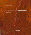
File:Makambako.png
Appearance

Size of this preview: 529 × 600 pixels. Other resolutions: 212 × 240 pixels | 538 × 610 pixels.
Original file (538 × 610 pixels, file size: 716 KB, MIME type: image/png)
File history
Click on a date/time to view the file as it appeared at that time.
| Date/Time | Thumbnail | Dimensions | User | Comment | |
|---|---|---|---|---|---|
| current | 11:18, 24 October 2010 |  | 538 × 610 (716 KB) | Blofeld Dr. | == Summary == {{convert to SVG|map}} {{Information |Description=Map of Makambako, Njombe District, Tanzania |Source=http://www.maps-for-free.com/ |Date=2010-10-24 |Author=Modified by Dr. Blofeld |Permission=http://www.maps-for-free.com/html/about.html |ot |
File usage
The following page uses this file:
Global file usage
The following other wikis use this file:
- Usage on el.wikipedia.org
- Usage on eo.wikipedia.org
- Usage on es.wikipedia.org
- Usage on fa.wikipedia.org
- Usage on fi.wikipedia.org
- Usage on ha.wikipedia.org
- Usage on ig.wikipedia.org
- Usage on ro.wikipedia.org
- Usage on sw.wikipedia.org
- Usage on ts.wikipedia.org
- Usage on www.wikidata.org
- Usage on yo.wikipedia.org
- Usage on zu.wikipedia.org


