File:Main towns in the province of Valencia.png
Appearance
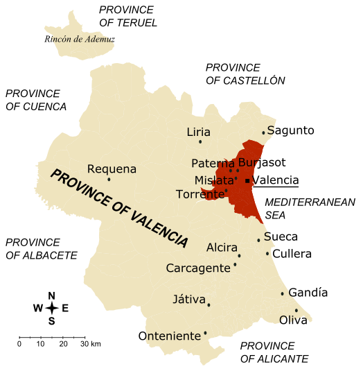
Main_towns_in_the_province_of_Valencia.png (524 × 535 pixels, file size: 108 KB, MIME type: image/png)
File history
Click on a date/time to view the file as it appeared at that time.
| Date/Time | Thumbnail | Dimensions | User | Comment | |
|---|---|---|---|---|---|
| current | 14:31, 10 December 2006 |  | 524 × 535 (108 KB) | Rodriguillo | '''Map of the province of Valencia''' (Spain) * The inner city and the towns conforming the first crown of Valencia metropolitan area are drawn in dark brown; together, they concentrate 60.62% of the province population in 5.73% of its surface, wi |
File usage
The following 2 pages use this file:
Global file usage
The following other wikis use this file:
- Usage on da.wikipedia.org
- Usage on fa.wikipedia.org
- Usage on fi.wikipedia.org
- Usage on no.wikipedia.org
- Usage on pam.wikipedia.org
- Usage on sco.wikipedia.org
- Usage on vi.wikipedia.org

