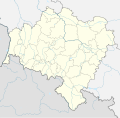
File:Lower Silesian Voivodeship Relief location map.svg
Appearance

Size of this PNG preview of this SVG file: 610 × 599 pixels. Other resolutions: 244 × 240 pixels | 489 × 480 pixels | 782 × 768 pixels | 1,043 × 1,024 pixels | 2,085 × 2,048 pixels | 902 × 886 pixels.
Original file (SVG file, nominally 902 × 886 pixels, file size: 1.83 MB)
File history
Click on a date/time to view the file as it appeared at that time.
| Date/Time | Thumbnail | Dimensions | User | Comment | |
|---|---|---|---|---|---|
| current | 03:23, 17 September 2018 |  | 902 × 886 (1.83 MB) | SANtosito | Correct projection and borders corrected |
| 20:29, 21 April 2018 |  | 2,449 × 2,386 (3.76 MB) | SANtosito | User created page with UploadWizard |
File usage
The following 11 pages use this file:
Global file usage
The following other wikis use this file:
- Usage on bn.wikipedia.org
- Usage on de.wikipedia.org
- Schlesiertalsperre
- Marklissa-Talsperre
- Talsperre Goldentraum
- Bobertalsperre
- Wölfelsgrunder Talsperre
- Burg Świny
- Lomnitztalsperre
- Ślęża
- Żórawina
- Glatzer Schneeberg
- Szrenica
- Wielka Sowa
- Szczeliniec Wielki
- Burg Chojnik
- Burg Ronow
- Krzyżna Góra
- Burg Świecie
- Chełmiec (Berg)
- Hohe Mense
- Burg Szczerba
- Góra Parkowa (Bielawa)
- Burg Nowy Dwór
- Burg Tzschocha
- Niedów-Stausee
- Dreiradenmühle
- Jezioro Paczkowskie
- Wysoki Kamień
- Burg Leśna
- Zackelfall
- Kochelfall
- Maria Mutter der Kirche (Dzierżoniów)
- Wysoka Kopa
- Sokolik
- Chojnik (Berg)
- Smogornia
- Mannsteine
- Mädelsteine
- Kleine Sturmhaube
- Große Sturmhaube (Riesengebirge)
- Kleine Koppe
- Schwarze Koppe
- Wielki Staw
- Mały Staw
- Hraniční hřeben
- Kleines Rad
- Czoło (Riesengebirge)
- Wołowa Góra
View more global usage of this file.

