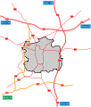
File:LodzDocelowyUkladDrog.svg
Appearance

Size of this PNG preview of this SVG file: 512 × 600 pixels. Other resolutions: 205 × 240 pixels | 410 × 480 pixels | 655 × 768 pixels | 874 × 1,024 pixels | 1,748 × 2,048 pixels | 1,648 × 1,931 pixels.
Original file (SVG file, nominally 1,648 × 1,931 pixels, file size: 128 KB)
File history
Click on a date/time to view the file as it appeared at that time.
| Date/Time | Thumbnail | Dimensions | User | Comment | |
|---|---|---|---|---|---|
| current | 15:25, 24 October 2009 |  | 1,648 × 1,931 (128 KB) | Sliwers | Texts to paths |
| 15:21, 24 October 2009 |  | 1,648 × 1,931 (92 KB) | Sliwers | Distances | |
| 17:04, 23 October 2009 |  | 1,648 × 1,931 (81 KB) | Sliwers | Thicker roads | |
| 20:42, 22 October 2009 |  | 1,648 × 1,931 (81 KB) | Sliwers | {{Information |Description={{pl|Docelowy układ dróg krajowych w Łodzi}} {{en|Map of the planned roads in Łódź}} Based on [http://www.uml.lodz.pl/_plik.php?id=220 Map from the City Council] |Source=*[[:File:Łódź_-_d |
File usage
The following page uses this file:
