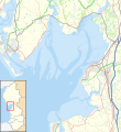
File:Location map United Kingdom Morecambe Bay.svg
Appearance

Size of this PNG preview of this SVG file: 549 × 600 pixels. Other resolutions: 220 × 240 pixels | 439 × 480 pixels | 703 × 768 pixels | 937 × 1,024 pixels | 1,875 × 2,048 pixels | 823 × 899 pixels.
Original file (SVG file, nominally 823 × 899 pixels, file size: 6.46 MB)
File history
Click on a date/time to view the file as it appeared at that time.
| Date/Time | Thumbnail | Dimensions | User | Comment | |
|---|---|---|---|---|---|
| current | 15:46, 23 January 2021 |  | 823 × 899 (6.46 MB) | Dr Greg | Uploaded a work by *North West England districts 2011 map.svg: Nilfanion, created using Ordnance Survey data *OpenStreetMap: [http://www.openstreetmap.org/copyright OpenStreetMap contributors] *derivative work: Dr Greg from {{Derived from|North West England districts 2011 map.svg|display=50}} * http://www.openstreetmap.org/#map=10/54.0960/-3.0336 accessed 21 January 2020 with UploadWizard |
File usage
The following 35 pages use this file:
- Aldingham
- Arnside
- Bardsea
- Bay Cycle Way
- Baycliff
- Bolton-le-Sands
- Canal Foot
- Chapel Island
- Cockerham
- Cockersand Abbey
- Cross Bay Walk
- Dova Haw
- Fleetwood
- Flookburgh
- Foulney Island
- Grange-over-Sands
- Headin Haw
- Heysham
- Islands of Furness
- Kents Bank
- Knott End-on-Sea
- Morecambe
- Morecambe Bay
- Newbiggin, Furness
- Piel Island
- Pilling
- Pilling Sands
- Rampside
- Roa Island
- Sheep Island (England)
- Silverdale, Lancashire
- Ulverston
- Walney Island
- Module:Location map/data/United Kingdom Morecambe Bay
- Module:Location map/data/United Kingdom Morecambe Bay/doc
Global file usage
The following other wikis use this file:
- Usage on fr.wikipedia.org
- Usage on si.wikipedia.org
- Usage on zh.wikipedia.org


