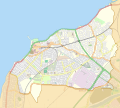
File:Location map United Kingdom Morecambe.svg
Appearance

Size of this PNG preview of this SVG file: 669 × 600 pixels. Other resolutions: 268 × 240 pixels | 536 × 480 pixels | 857 × 768 pixels | 1,143 × 1,024 pixels | 2,285 × 2,048 pixels | 944 × 846 pixels.
Original file (SVG file, nominally 944 × 846 pixels, file size: 1.22 MB)
File history
Click on a date/time to view the file as it appeared at that time.
| Date/Time | Thumbnail | Dimensions | User | Comment | |
|---|---|---|---|---|---|
| current | 23:08, 27 July 2014 |  | 944 × 846 (1.22 MB) | Dr Greg | User created page with UploadWizard |
File usage
The following 25 pages use this file:
- Bare, Morecambe
- Central Pier, Morecambe
- Christie Park (Morecambe)
- Church of St John the Divine, Morecambe
- Clark Street Congregational Church, Morecambe
- Holy Trinity Church, Morecambe
- Mazuma Mobile Stadium
- Midland Hotel, Morecambe
- Morecambe
- Morecambe (Northumberland Street) railway station
- Morecambe Euston Road railway station
- Morecambe Harbour railway station
- Morecambe Promenade railway station
- Morecambe Town Hall
- Morecambe Winter Gardens
- Morecambe railway station
- North Western Hotel, Morecambe
- St Barnabas' Church, Morecambe
- St Laurence's Church, Morecambe
- Stone Jetty
- Torrisholme
- West End Pier, Morecambe
- User:Nthep/Morecambe Tower
- Module:Location map/data/United Kingdom Morecambe
- Module:Location map/data/United Kingdom Morecambe/doc
Global file usage
The following other wikis use this file:
- Usage on ar.wikipedia.org
- Usage on pl.wikivoyage.org
- Usage on si.wikipedia.org


