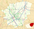
File:Location map United Kingdom Borough of Doncaster.svg
Appearance

Size of this PNG preview of this SVG file: 700 × 600 pixels. Other resolutions: 280 × 240 pixels | 560 × 480 pixels | 896 × 768 pixels | 1,195 × 1,024 pixels | 2,390 × 2,048 pixels | 1,425 × 1,221 pixels.
Original file (SVG file, nominally 1,425 × 1,221 pixels, file size: 8.36 MB)
File history
Click on a date/time to view the file as it appeared at that time.
| Date/Time | Thumbnail | Dimensions | User | Comment | |
|---|---|---|---|---|---|
| current | 13:35, 2 June 2019 |  | 1,425 × 1,221 (8.36 MB) | Dr Greg | Correction to colour of A630 |
| 13:10, 1 June 2019 |  | 1,425 × 1,221 (8.36 MB) | Dr Greg | User created page with UploadWizard |
File usage
The following 41 pages use this file:
- Austerfield
- Barnburgh
- Bawtry
- Belle Vue, South Yorkshire
- Bentley, South Yorkshire
- Bessacarr
- Cadeby, South Yorkshire
- City of Doncaster
- Clayton, South Yorkshire
- Conisbrough
- Cusworth
- Don Bridge
- Doncaster
- Finningley
- Hampole
- Hatfield, South Yorkshire
- Hickleton
- High Melton
- Hooton Pagnell
- Intake, Doncaster
- Lakeside, South Yorkshire
- Little Canada, South Yorkshire
- Loversall
- Marr, South Yorkshire
- Mexborough
- Moorends
- Norton, Doncaster
- Owston, South Yorkshire
- Rossington
- Scawsby
- Scawthorpe
- Sprotbrough
- Sykehouse
- Thorne, South Yorkshire
- Tickhill
- Town Fields
- Wheatley, South Yorkshire
- Wheatley Hills
- Woodlands, South Yorkshire
- Module:Location map/data/United Kingdom Borough of Doncaster
- Module:Location map/data/United Kingdom Borough of Doncaster/doc
Global file usage
The following other wikis use this file:
- Usage on fa.wikipedia.org
- Usage on si.wikipedia.org
- Usage on uz.wikipedia.org

