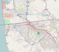
File:Location map Tijuana.png
Appearance

Size of this preview: 674 × 599 pixels. Other resolutions: 270 × 240 pixels | 540 × 480 pixels | 823 × 732 pixels.
Original file (823 × 732 pixels, file size: 529 KB, MIME type: image/png)
File history
Click on a date/time to view the file as it appeared at that time.
| Date/Time | Thumbnail | Dimensions | User | Comment | |
|---|---|---|---|---|---|
| current | 17:20, 7 April 2013 |  | 823 × 732 (529 KB) | Keizers | User created page with UploadWizard |
File usage
The following 13 pages use this file:
- Agua Caliente, Tijuana
- Cerro Colorado (borough)
- Cross Border Xpress
- Downtown Tijuana
- La Presa Este, Tijuana
- Oasis of Hope Hospital
- Otay Centenario
- Playas de Tijuana
- San Antonio de los Buenos
- Sánchez Taboada (borough)
- Tijuana International Airport
- Module:Location map/data/Mexico Tijuana
- Module:Location map/data/Mexico Tijuana/doc
Global file usage
The following other wikis use this file:
- Usage on ar.wikipedia.org
- Usage on ceb.wikipedia.org
- Usage on fa.wikipedia.org
- Usage on fr.wikipedia.org
- Usage on hu.wikipedia.org
- Usage on it.wikipedia.org
- Usage on kn.wikipedia.org
- Usage on ko.wikipedia.org
- Usage on si.wikipedia.org
- Usage on tr.wikipedia.org
- Usage on vep.wikipedia.org
- Usage on war.wikipedia.org
- Usage on zh.wikipedia.org
