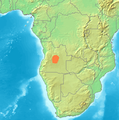
File:Location Bié.PNG
Appearance
Location_Bié.PNG (361 × 363 pixels, file size: 97 KB, MIME type: image/png)
File history
Click on a date/time to view the file as it appeared at that time.
| Date/Time | Thumbnail | Dimensions | User | Comment | |
|---|---|---|---|---|---|
| current | 03:16, 23 November 2021 |  | 361 × 363 (97 KB) | Hallel | Reverted to version as of 14:38, 29 June 2007 (UTC) |
| 15:59, 11 August 2021 |  | 361 × 363 (241 KB) | Fährtenleser | falsche Lage korrigiert (Grundlage: http://mountainbiodiversity.org/explore sowie Topographie | |
| 14:38, 29 June 2007 |  | 361 × 363 (97 KB) | Michiel1972 | {{Information |Description=Locator maps for mountain ranges , Bié (Angola) |Source=demis maps, see below |Date= |Author= |Permission=see below |other_versions= }} {{PD-Demis}} Category:Maps of mountain_ranges_of_Europe |
File usage
The following page uses this file:
Global file usage
The following other wikis use this file:
- Usage on bg.wikipedia.org
- Usage on ca.wikipedia.org
- Usage on ceb.wikipedia.org
- Usage on cs.wikipedia.org
- Usage on de.wikipedia.org
- Usage on es.wikipedia.org
- Usage on fr.wikipedia.org
- Usage on he.wikipedia.org
- Usage on hr.wikipedia.org
- Usage on hu.wikipedia.org
- Usage on it.wikipedia.org
- Usage on lt.wikipedia.org
- Usage on nl.wikipedia.org
- Usage on pl.wikipedia.org
- Usage on pt.wikipedia.org
- Usage on sh.wikipedia.org
- Usage on uk.wikipedia.org
- Usage on www.wikidata.org
- Usage on zh.wikipedia.org
