File:Level IV ecoregions, Columbia Plateau.gif
Appearance

Size of this preview: 558 × 600 pixels. Other resolutions: 223 × 240 pixels | 447 × 480 pixels | 715 × 768 pixels | 1,221 × 1,312 pixels.
Original file (1,221 × 1,312 pixels, file size: 351 KB, MIME type: image/gif, 0.1 s)
File history
Click on a date/time to view the file as it appeared at that time.
| Date/Time | Thumbnail | Dimensions | User | Comment | |
|---|---|---|---|---|---|
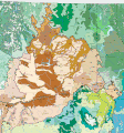
| current | 07:07, 1 May 2022 |  | 1,221 × 1,312 (351 KB) | Hike395 | == {{int:filedesc}} == {{Information |Description={{en|1= Level IV ecoregions in the Columbia Plateau ecoregion, as defined by the EPA. This map is a draft and may now be slightly outdated. For more information about these ecoregions, see [http://www.epa.gov/wed/pages/ecoregions.htm]}} |Source={{Derived from|Level IV ecoregions, Columbia Plateau.png|display=50}} |Date=2022-05-01 07:04 (UTC) |Author=* [[:File:Level IV ecoregions, Columbia Plateau.png|File:Level IV ecoregions, Columbia Plateau.... |
File usage
The following page uses this file:


