
File:Levanger map 1909.jpg
Size of this preview: 800 × 300 pixels. Other resolutions: 320 × 120 pixels | 640 × 240 pixels | 1,024 × 384 pixels | 1,280 × 480 pixels | 3,000 × 1,124 pixels.
Original file (3,000 × 1,124 pixels, file size: 2.53 MB, MIME type: image/jpeg)
| This is a file from the Wikimedia Commons. Information from its description page there is shown below. Commons is a freely licensed media file repository. You can help. |
File history
Click on a date/time to view the file as it appeared at that time.
| Date/Time | Thumbnail | Dimensions | User | Comment | |
|---|---|---|---|---|---|
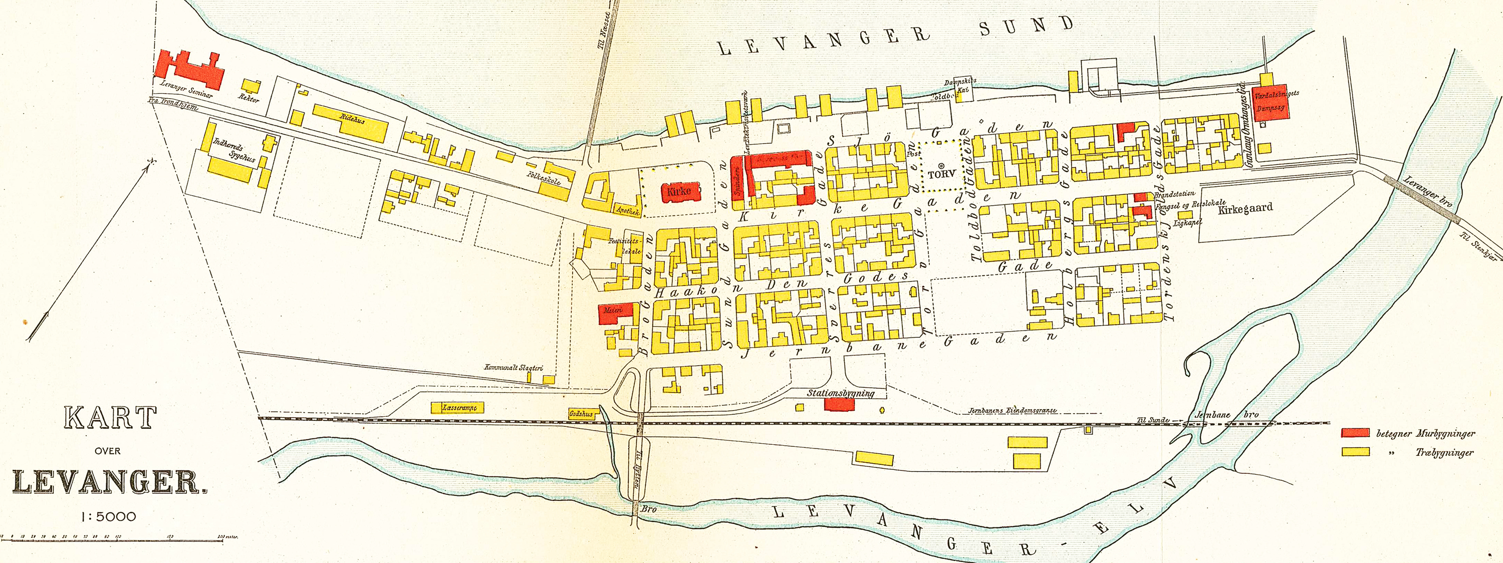
| current | 18:29, 19 June 2008 | 3,000 × 1,124 (2.53 MB) | Mahlum | {{Information |Description={{no|1=Kart over Levanger, 1909}} |Source=Topografisk-statistisk Beskrivelse over Nordre Trondhjems Amt |Author=Den private Opmaaling |Date=1909 |Permission= |other_versions= }} {{ImageUpload|full}} Category:Levanger [[Cate |
File usage
The following 4 pages use this file:
Global file usage
The following other wikis use this file:
- Usage on da.wikipedia.org
- Usage on no.wikipedia.org