
File:Levaillant map.png
Size of this preview: 800 × 586 pixels. Other resolutions: 320 × 234 pixels | 640 × 469 pixels | 1,024 × 750 pixels | 1,280 × 938 pixels | 2,560 × 1,875 pixels | 5,384 × 3,944 pixels.
Original file (5,384 × 3,944 pixels, file size: 31.28 MB, MIME type: image/png)
| This is a file from the Wikimedia Commons. Information from its description page there is shown below. Commons is a freely licensed media file repository. You can help. |
Summary
| Description |
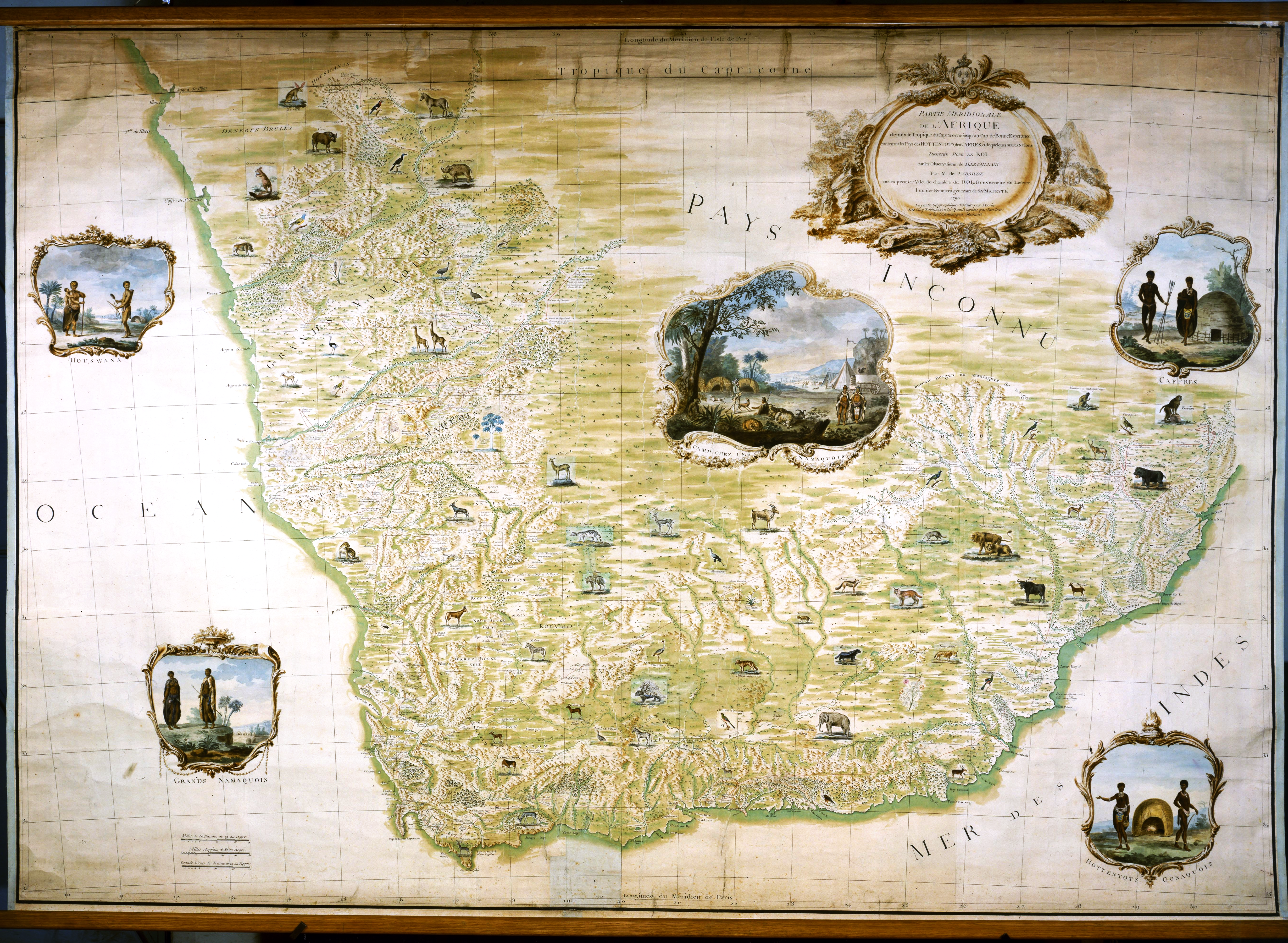
Afrikaans: Suidelike deel van Afrika van die Steenbokskeerkring tot die Kaap die Goeie Hoop wat die Lande van die Hottentotte, die Kaffers en 'n paar ander nasies omvat — vir die Koning uit mnr. Le Vaillant se waarnemings saamgestel deur mnr. de Laborde, voormalige Eerste Hofdienaar van die Koning, Goewerneur van die Louvre en een van Sy Majesteit se Landbouer-generaals.
English: Southern part of Africa from the Tropic of Capricorn to the Cape of Good Hope containing the Countries of the Hottentots, the Kaffirs and some other Nations — drawn up for the King on the observations of Mr. Le Vaillant by Mr. de Laborde, former first valet of the King, governor of the Louvre, one of His Majesty's Farmers General
Français : Partie Méridionale de l'Afrique depuis le Tropique du Capricorne jusqu'au Cap de Bonne Espérance contenant les Pays des Hottentots, des Cafres et de quelques autres Nations / dressée pour le Roi sur les observations de M. Le Vaillant par M. de Laborde, ancien premier valet de chambre du Roi, gouverneur du Louvre, l'un des Fermiers généraux de Sa Majesté. |
||||
| Date | |||||
| Source | http://gallica.bnf.fr/ark:/12148/btv1b7759098g/f1.item.zoom | ||||
| Author | La Borde, Jean-Benjamin de (1734-1794), Levaillant, François (1753-1824) | ||||
| Permission (Reusing this file) |
|
||||
File history
Click on a date/time to view the file as it appeared at that time.
| Date/Time | Thumbnail | Dimensions | User | Comment | |
|---|---|---|---|---|---|
| current | 05:58, 6 October 2017 | | 5,384 × 3,944 (31.28 MB) | Shyamal | {{Information |Description=Partie Méridionale de l'Afrique depuis le Tropique du Capricorne jusqu'au Cap de Bonne Espérance contenant les Pays des Hottentots, des Cafres et de quelques autres Nations / dressée pour le Roi sur les observations de M.... |
File usage
The following page uses this file:
Global file usage
The following other wikis use this file:
- Usage on et.wikipedia.org