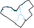
File:Lebreton Flats locator map.png
Appearance
Lebreton_Flats_locator_map.png (357 × 297 pixels, file size: 7 KB, MIME type: image/png)
File history
Click on a date/time to view the file as it appeared at that time.
| Date/Time | Thumbnail | Dimensions | User | Comment | |
|---|---|---|---|---|---|
| current | 20:38, 4 April 2006 |  | 357 × 297 (7 KB) | Jkelly | *Author: en:User:Earl Andrew *Description: Locator map of Lebreton Flats, a neighbourhood in Ottawa. *Date: Uploaded as en:Image:Lebretonflatsottawa.PNG on July 20 2005 {{PD-user-wikimedia|Earl Andrew|en}} [[Category:Lebreton Flat |
File usage
The following page uses this file:
Global file usage
The following other wikis use this file:
- Usage on fr.wikipedia.org
- Usage on ru.wikipedia.org
- Usage on www.wikidata.org

