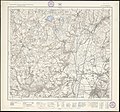
File:Landkarte 168 Weingarten 1914.jpg
Appearance

Size of this preview: 601 × 600 pixels. Other resolutions: 240 × 240 pixels | 481 × 480 pixels | 769 × 768 pixels | 1,026 × 1,024 pixels | 2,362 × 2,358 pixels.
Original file (2,362 × 2,358 pixels, file size: 2.53 MB, MIME type: image/jpeg)
File history
Click on a date/time to view the file as it appeared at that time.
| Date/Time | Thumbnail | Dimensions | User | Comment | |
|---|---|---|---|---|---|
| current | 08:56, 8 September 2008 |  | 2,362 × 2,358 (2.53 MB) | Lupo | {{Information |Description={{en|1=Topographic map of the Kingdom of Württemberg, 1:25,000; sheet 168: Weingarten. Copper engraving by Hugo Petters.}} {{de|1=Topographische Karte des Königreichs Württemberg, 1:25'000, Blatt 168: Weingarten. Kupferstich |
File usage
No pages on the English Wikipedia use this file (pages on other projects are not listed).
Global file usage
The following other wikis use this file:
- Usage on de.wikipedia.org

