
File:Koppen classification worldmap A.png

Size of this preview: 800 × 512 pixels. Other resolutions: 320 × 205 pixels | 640 × 410 pixels | 1,024 × 655 pixels | 1,280 × 819 pixels | 2,000 × 1,280 pixels.
Original file (2,000 × 1,280 pixels, file size: 102 KB, MIME type: image/png)
| This is a file from the Wikimedia Commons. Information from its description page there is shown below. Commons is a freely licensed media file repository. You can help. |
Summary
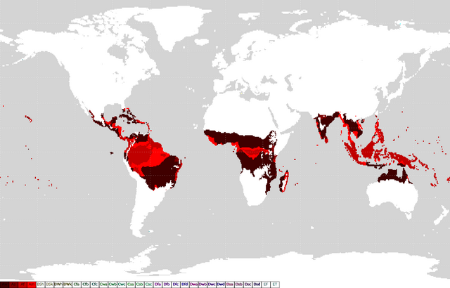
Area of Tropical climate.
Map based Image:Köppen classification worldmap.png.
Licensing
| This work has been released into the public domain by its author, みれでぃー. This applies worldwide. In some countries this may not be legally possible; if so: |
File history
Click on a date/time to view the file as it appeared at that time.
| Date/Time | Thumbnail | Dimensions | User | Comment | |
|---|---|---|---|---|---|
| current | 04:40, 10 December 2006 | | 2,000 × 1,280 (102 KB) | Pekachu | gray background |
| 09:29, 7 November 2006 |  | 2,000 × 1,280 (102 KB) | Pekachu | Area of Tropical climate. Map based Image:Köppen classification worldmap.png. ==Licensing== {{PD-user|みれでぃー}} Category:Weather and climate maps |
File usage
The following page uses this file:
Global file usage
The following other wikis use this file:
- Usage on bg.wikipedia.org
- Usage on ca.wikipedia.org
- Usage on et.wikipedia.org
- Usage on fr.wikipedia.org
- Usage on hi.wikipedia.org
- Usage on hu.wikibooks.org
- Usage on it.wikibooks.org
- Usage on ja.wikibooks.org
- Usage on ko.wikipedia.org
- Usage on nv.wikipedia.org
- Usage on sr.wikipedia.org
- Usage on zh.wikipedia.org