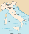
File:Kingdom of Italy 1870 map.svg
Appearance

Size of this PNG preview of this SVG file: 510 × 600 pixels. Other resolutions: 204 × 240 pixels | 408 × 480 pixels | 653 × 768 pixels | 871 × 1,024 pixels | 1,742 × 2,048 pixels | 3,360 × 3,950 pixels.
Original file (SVG file, nominally 3,360 × 3,950 pixels, file size: 1.29 MB)
File history
Click on a date/time to view the file as it appeared at that time.
| Date/Time | Thumbnail | Dimensions | User | Comment | |
|---|---|---|---|---|---|
| current | 22:32, 1 August 2011 |  | 3,360 × 3,950 (1.29 MB) | F l a n k e r | Minor improvements |
| 15:17, 22 June 2011 |  | 3,360 × 3,950 (833 KB) | Gigillo83 | == Summary == {{Information |Description={{en|map of the Kingdom of Italy (Regno d'Italia) in 1870 with provinces.}} {{it|cartina del Regno d'Italia nel 1870 con le province.}} |Source={{own}}, original from {{DerivativeVersions|Kingdom of Italy 1919 map. |
File usage
The following page uses this file:
Global file usage
The following other wikis use this file:
- Usage on frr.wikipedia.org
- Usage on fr.wikipedia.org
- Usage on sh.wikipedia.org
- Usage on sl.wikipedia.org


