File:Kemp Land stub map.png
Kemp_Land_stub_map.png (239 × 334 pixels, file size: 17 KB, MIME type: image/png)
| Description |
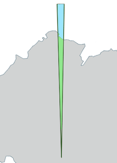
Template map of Kemp Land, Antarctica. | ||
|---|---|---|---|
| Source |
Generated from File:Antarctica,_territorial_claims.svg (Lokal_Profil) by myself (User:Grutness) | ||
| Date | |||
| Author |
| ||
| Permission (Reusing this file) |
See below.
|
Template map of Kemp Land, Antarctica. Generated from File:Antarctica,_territorial_claims.svg (
| This work is licensed under the Creative Commons Attribution-ShareAlike 2.5 License. Attribution: Lokal_Profil |
) by myself (User:Grutness)
 | This file is a candidate to be copied to Wikimedia Commons.
Any user may perform this transfer; refer to Wikipedia:Moving files to Commons for details. If this file has problems with attribution, copyright, or is otherwise ineligible for Commons, then remove this tag and DO NOT transfer it; repeat violators may be blocked from editing. Other Instructions
| ||
| |||
File history
Click on a date/time to view the file as it appeared at that time.
| Date/Time | Thumbnail | Dimensions | User | Comment | |
|---|---|---|---|---|---|
| current | 13:02, 8 July 2011 |  | 239 × 334 (17 KB) | Grutness (talk | contribs) | Template map of Kemp Land, Antarctica. Generated from File:Antarctica,_territorial_claims.svg ({{cc-by-sa-2.5|Lokal_Profil}}) by myself (User:Grutness) |
You cannot overwrite this file.
File usage
The following 66 pages use this file:
- Abrupt Island
- Abrupt Point
- Achernar Island
- Alphard Island
- Austnes Peninsula
- Bell Bay (Antarctica)
- Billingane Peaks
- Blackrock Head
- Borg Island
- Broka Island
- Brusen Nunatak
- Cape Gotley
- Cirque Fjord
- Depot Island, Kemp Land
- Dwyer Nunataks
- East Stack
- Edward VIII Bay
- Fold Island
- Galtefjellet
- Gwynn Bay
- Hansen Mountains
- Havstein Island
- Håkollen Island
- Ives Tongue
- Karm Island (Antarctica)
- Keel Island
- Kemp Coast
- Kemp Land
- Kemp Peak
- Kjuklingen Nunatak
- Kloa Point
- Kring Islands
- Krok Island
- Lang Island (Antarctica)
- Lang Sound
- Law Promontory
- Leslie Peak
- Martin Island (Antarctica)
- McCarthy Island (Kemp Land)
- Melfjellet
- Mount Allport
- Mount Gjeita
- Mount Saint Michael (Antarctica)
- Mount Saw
- Mount Treatt
- Mule Point
- Patricia Islands
- Purka Mountain
- Rigel Skerries
- Secluded Rocks
- See Nunatak
- Shaula Island
- Sirius Islands
- Solitary Nunatak
- Stack Bay
- Stefansson Bay
- Stillwell Hills
- Styles Bluff
- Svart Peak
- Syningen Nunatak
- Tillett Islands
- Transverse Island
- Tryne Point
- West Stack
- Øygarden Group
- Template:KempLand-geo-stub

