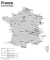
File:Karte der ÖPNV-Systeme in Spanien und Portugal.png
Appearance

Size of this preview: 757 × 600 pixels. Other resolutions: 303 × 240 pixels | 606 × 480 pixels | 969 × 768 pixels | 1,280 × 1,014 pixels | 2,560 × 2,028 pixels | 3,303 × 2,617 pixels.
Original file (3,303 × 2,617 pixels, file size: 927 KB, MIME type: image/png)
File history
Click on a date/time to view the file as it appeared at that time.
| Date/Time | Thumbnail | Dimensions | User | Comment | |
|---|---|---|---|---|---|
| current | 17:44, 9 December 2022 |  | 3,303 × 2,617 (927 KB) | Andreuvv | Added Cádiz and updated logos |
| 18:44, 30 January 2018 |  | 3,303 × 2,617 (791 KB) | Chumwa | update | |
| 14:02, 17 June 2017 |  | 3,303 × 2,617 (791 KB) | Chumwa | update | |
| 21:31, 29 November 2014 |  | 3,303 × 2,617 (725 KB) | Chumwa | corrected coastlines of the islands | |
| 21:24, 29 November 2014 |  | 3,303 × 2,617 (762 KB) | Chumwa | added colours, not any mor an island map | |
| 05:56, 28 November 2014 |  | 2,339 × 1,654 (464 KB) | Chumwa | update | |
| 09:08, 5 August 2007 |  | 2,324 × 1,651 (443 KB) | Chumwa | correction | |
| 09:05, 5 August 2007 |  | 2,324 × 1,651 (443 KB) | Chumwa | added Granada | |
| 19:08, 27 July 2007 |  | 2,324 × 1,651 (440 KB) | Chumwa | {{Information |Description= *{{ de }} Karte der Streckengebundenen Nahverkehrssysteme in Spanien und Portugal *{{ en }} Map of Light Rail Transit Systems in Spain and Portugal |Source=Self made Created with Adobe Illustrator If you ask for, I will give |
File usage
The following page uses this file:
Global file usage
The following other wikis use this file:
- Usage on cs.wikipedia.org
- Usage on de.wikipedia.org
- Usage on de.wikivoyage.org
- Usage on sk.wikipedia.org


