File:Karte Schmallenberg v1.jpg
Appearance

Size of this preview: 647 × 599 pixels. Other resolutions: 259 × 240 pixels | 518 × 480 pixels | 829 × 768 pixels | 1,105 × 1,024 pixels | 2,211 × 2,048 pixels | 3,098 × 2,870 pixels.
Original file (3,098 × 2,870 pixels, file size: 3.62 MB, MIME type: image/jpeg)
File history
Click on a date/time to view the file as it appeared at that time.
| Date/Time | Thumbnail | Dimensions | User | Comment | |
|---|---|---|---|---|---|
| current | 18:36, 8 November 2011 |  | 3,098 × 2,870 (3.62 MB) | SteveK | Korrektur Legende |
| 19:35, 24 April 2008 |  | 3,098 × 2,870 (3.63 MB) | SteveK | ||
| 20:38, 23 April 2008 |  | 3,098 × 2,870 (3.64 MB) | SteveK | ||
| 20:24, 23 April 2008 |  | 3,098 × 2,870 (3.65 MB) | SteveK | ||
| 20:34, 21 April 2008 |  | 3,098 × 2,870 (3.66 MB) | SteveK | ||
| 19:34, 20 April 2008 |  | 3,098 × 2,828 (3.56 MB) | SteveK | ||
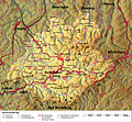
| 18:44, 19 April 2008 |  | 3,098 × 2,828 (3.55 MB) | SteveK | {{Information |Description= Topografische Karte von Schmallenberg / Stadtgebiet hervorgehoben |Source=eigene Arbeit |Date=19. April 2008 |Author= SteveK |Permission= |other_versions= }} Category:Schmallenberg |
File usage
The following page uses this file:
Global file usage
The following other wikis use this file:
- Usage on azb.wikipedia.org
- Usage on ca.wikipedia.org
- Usage on de.wikipedia.org
- Usage on fr.wikipedia.org
- Usage on ja.wikipedia.org
- Usage on lb.wikipedia.org
- Usage on nl.wikipedia.org
- Usage on uk.wikipedia.org

