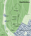
File:Karte Kapellenberg.png
Appearance

Size of this preview: 518 × 599 pixels. Other resolutions: 207 × 240 pixels | 415 × 480 pixels | 664 × 768 pixels | 885 × 1,024 pixels | 1,942 × 2,246 pixels.
Original file (1,942 × 2,246 pixels, file size: 3.01 MB, MIME type: image/png)
File history
Click on a date/time to view the file as it appeared at that time.
| Date/Time | Thumbnail | Dimensions | User | Comment | |
|---|---|---|---|---|---|
| current | 18:27, 30 November 2010 |  | 1,942 × 2,246 (3.01 MB) | NordNordWest | c |
| 20:15, 29 November 2010 |  | 2,166 × 2,246 (3.21 MB) | NordNordWest | =={{int:filedesc}}== {{Information |Description= {{de|Karte des Kapellenbergs bei Hofheim am Taunus}} {{en|Map of Kapellenberg near Hofheim am Taunus, Germany}} |Source={{Own}}, using |Date=2010-11-29 |Author={{U|NordNordWes |
File usage
The following page uses this file:
Global file usage
The following other wikis use this file:
- Usage on de.wikipedia.org


