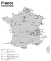
File:Karte ÖPNV-Systeme in Italien.png
Appearance

Size of this preview: 800 × 549 pixels. Other resolutions: 320 × 220 pixels | 640 × 439 pixels | 1,024 × 703 pixels | 1,280 × 878 pixels | 2,260 × 1,551 pixels.
Original file (2,260 × 1,551 pixels, file size: 355 KB, MIME type: image/png)
File history
Click on a date/time to view the file as it appeared at that time.
| Date/Time | Thumbnail | Dimensions | User | Comment | |
|---|---|---|---|---|---|
| current | 20:04, 3 June 2019 |  | 2,260 × 1,551 (355 KB) | Chumwa | update |
| 07:37, 2 January 2016 |  | 2,260 × 1,551 (353 KB) | Chumwa | Schriftart korrigiert | |
| 07:33, 2 January 2016 |  | 2,260 × 1,551 (353 KB) | Chumwa | update | |
| 19:22, 13 November 2015 |  | 2,260 × 1,551 (354 KB) | Chumwa | Ergänzungen | |
| 20:21, 20 November 2014 |  | 2,260 × 1,551 (355 KB) | Chumwa | Cremona raus; Kabinenbahnen, öffentliche Aufzüge und Rolltreppen hinzugefügt | |
| 20:06, 18 November 2014 |  | 2,260 × 1,551 (300 KB) | Chumwa | diverse Aktualisierungen und Korrekturen | |
| 20:21, 28 July 2014 |  | 2,260 × 1,551 (329 KB) | Chumwa | Kartenstand korrigiert | |
| 18:05, 21 April 2013 |  | 3,508 × 2,480 (512 KB) | Chumwa | update | |
| 09:25, 10 September 2012 |  | 1,630 × 1,126 (142 KB) | Kopiersperre | OptiPNG | |
| 06:46, 30 July 2006 |  | 1,630 × 1,126 (244 KB) | Chumwa | *'''Description:''' Übersicht über die streckengebundenen ÖPNV-Systeme von Italien (Stand: Juli 2006) *'''Source:''' Maximilian Dörrbecker {{GFDL}} Category:mapCategory:KarteCategory:ÖPNVCategory:puplic transpotCategory:Italy[[C |
File usage
The following page uses this file:
Global file usage
The following other wikis use this file:
- Usage on cs.wikipedia.org
- Usage on de.wikipedia.org
- Usage on de.wikibooks.org
- Usage on hu.wikipedia.org
- Usage on sh.wikipedia.org
- Usage on sk.wikipedia.org
- Usage on sr.wikipedia.org


