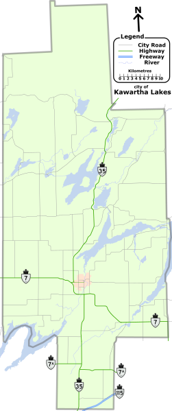
File:KL Road Map.svg
Appearance

Size of this PNG preview of this SVG file: 251 × 599 pixels. Other resolutions: 100 × 240 pixels | 201 × 480 pixels | 322 × 768 pixels | 429 × 1,024 pixels | 858 × 2,048 pixels | 595 × 1,420 pixels.
Original file (SVG file, nominally 595 × 1,420 pixels, file size: 570 KB)
File history
Click on a date/time to view the file as it appeared at that time.
| Date/Time | Thumbnail | Dimensions | User | Comment | |
|---|---|---|---|---|---|
| current | 18:17, 17 June 2013 |  | 595 × 1,420 (570 KB) | File Upload Bot (Magnus Manske) | Transfered from en.wikipedia by User:Quadell using CommonsHelper |
File usage
The following 60 pages use this file:
- Ancona Point, Ontario
- Balsam Lake (Ontario)
- Bethany, Ontario
- Bexley Township
- Bobcaygeon
- Bolsover, Ontario
- Burnt River, Ontario
- Cameron, Ontario
- Cameron Lake (Ontario)
- Canal Lake
- Carden Township
- Coboconk
- Cranberry Lake (Ontario)
- Dalton Township, Ontario
- Dongola, Ontario
- Eldon Township
- Emily Township
- Fenelon Falls
- Fenelon Township
- Four Mile Lake (Ontario)
- Glenarm, Ontario
- Gull River (Balsam Lake)
- Head Lake, Ontario
- Head Lake (Kawartha Lakes)
- Kawartha Lakes
- Kawartha Lakes (Ontario)
- Kinmount
- Kirkfield
- Kirkfield Lift Lock
- Lake Scugog
- Laxton, Digby and Longford Township
- Lindsay, Ontario
- List of numbered roads in Kawartha Lakes
- Little Britain, Ontario
- Lorneville, Ontario
- Manvers Township
- Mariposa Township, Ontario
- Mitchell Lake (Ontario)
- Norland, Ontario
- Omemee, Ontario
- Ops Township
- Pigeon Lake (Ontario)
- Pontypool, Ontario
- Rokeby, Ontario
- Rosedale, Ontario
- Shadow Lake (Kawartha Lakes)
- Silver Lake (Kawartha Lakes)
- Somerville Township
- St. Mary's, Kawartha Lakes, Ontario
- Sturgeon Lake (Ontario)
- Talbot River (Ontario)
- Valentia, Ontario
- Verulam Park, Ontario
- Verulam Township
- Victoria Road, Ontario
- View Lake, Ontario
- Woodville, Ontario
- User:Floydian/sandbox/generic
- Wikipedia:WikiProject Ontario/Kawartha Lakes
- Template:City of Kawartha Lakes

