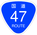
File:Japanese National Route Sign 0047.svg
Appearance

Size of this PNG preview of this SVG file: 455 × 435 pixels. Other resolutions: 251 × 240 pixels | 502 × 480 pixels | 803 × 768 pixels | 1,071 × 1,024 pixels | 2,142 × 2,048 pixels.
Original file (SVG file, nominally 455 × 435 pixels, file size: 9 KB)
File history
Click on a date/time to view the file as it appeared at that time.
| Date/Time | Thumbnail | Dimensions | User | Comment | |
|---|---|---|---|---|---|
| current | 15:03, 3 September 2009 |  | 455 × 435 (9 KB) | Monaneko | Fix : 番号にIPAフォント(IPAGothic)のアウトラインパスを使用(IPAフォントは商用利用可能)。 |
| 19:44, 16 December 2006 |  | 455 × 435 (9 KB) | Excl-zoo | {{Information |Description=This is a diagram of Japanese National Route Sign. The glyphs of <span lang="ja">国道</span> are the outline path from free font that is "NARAYAMA Maru Gothic" created by excl-zoo, based on "Wadalab Hosomaru Go | |
| 19:50, 13 December 2006 |  | 450 × 431 (9 KB) | Excl-zoo | {{Information |Description=This is a diagram of Japanese National Route Sign. The glyphs of <span lang="ja">国道</span> are the outline path from free font that is "NARAYAMA Maru Gothic" created by excl-zoo, based on "Wadalab Hosomaru Got |
File usage
The following 36 pages use this file:
- Akakura-Onsen Station
- Funagata, Yamagata
- Higashi-Nagasawa Station
- Japan National Route 108
- Japan National Route 112
- Japan National Route 345
- Japan National Route 4
- Japan National Route 45
- Japan National Route 46
- Japan National Route 47
- Japan National Route 48
- Japan National Route 6
- Japan National Route 7
- List of highways numbered 47
- List of national highways of Japan
- Miyagi Prefecture
- Mogami, Yamagata
- Mogami Station
- Nihonkai-Tōhoku Expressway
- Sakaida Station
- Sakata, Yamagata
- Semi-Onsen Station
- Sendai
- Sendai-Hokubu Road
- Shinjō, Yamagata
- Shinjō Station
- Shōnai, Yamagata
- Tachikōji Station
- Taiwa, Miyagi
- Tozawa, Yamagata
- Tōhoku-Chūō Expressway
- Tōhoku Expressway
- Usugi Station
- Ōhira, Miyagi
- Ōhori Station
- Ōsaki, Miyagi
Global file usage
The following other wikis use this file:
- Usage on af.wikipedia.org
- Usage on de.wikipedia.org
- Usage on en.wikivoyage.org
- Usage on es.wikipedia.org
- Usage on id.wikipedia.org
- Usage on ja.wikipedia.org
- 国道7号
- 国道13号
- 国道47号
- 仙台北部道路
- 古川インターチェンジ
- 国道108号
- 仙台バイパス
- 国道345号
- 国道346号
- 国道457号
- 国道458号
- 新庄酒田道路
- あ・ら・伊達な道の駅
- 道の駅とざわ
- 新庄インターチェンジ
- 堺田越
- 山形県道36号新庄次年子村山線
- 山形県道28号尾花沢最上線
- 山形県道30号大石田畑線
- 山形県道56号新庄舟形線
- 山形県道34号新庄戸沢線
- 山形県道57号戸沢大蔵線
- 山形県道・宮城県道63号最上鬼首線
- 富谷バイパス
- 宮城県道17号栗駒岩出山線
- 山形県道33号庄内空港立川線
- 山形県道38号酒田鶴岡線
- 山形県道40号酒田松山線
- 山形県道43号余目加茂線
- 山形県道44号余目温海線
- 亀割バイパス (山形県)
- 庄内東部広域農道
- 山形県道45号立川羽黒山線
- 苦竹インターチェンジ
- 岩出山バイパス
- 川渡バイパス
- 余目バイパス
- 利用者:ある男/sandbox
- 三本木バイパス
- Template:国道47号
View more global usage of this file.

