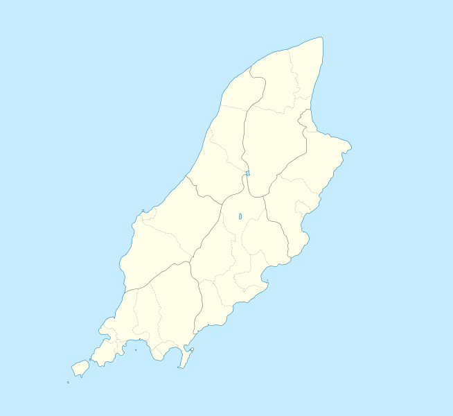
File:Isle of Man location map.svg
Appearance

Size of this PNG preview of this SVG file: 654 × 600 pixels. Other resolutions: 262 × 240 pixels | 524 × 480 pixels | 838 × 768 pixels | 1,117 × 1,024 pixels | 2,234 × 2,048 pixels | 1,200 × 1,100 pixels.
Original file (SVG file, nominally 1,200 × 1,100 pixels, file size: 93 KB)
File history
Click on a date/time to view the file as it appeared at that time.
| Date/Time | Thumbnail | Dimensions | User | Comment | |
|---|---|---|---|---|---|
| current | 23:00, 24 September 2009 |  | 1,200 × 1,100 (93 KB) | Entlinkt | {{Information |Description={{en|1=Location map of the Isle of Man, showing sheadings as well as local authorities (towns, villages, districts, parishes). Geographic limits of the map: * W: -4° 58' 0" * E: -4° 7' 0" * S: 54° 0' 0" * N: 54° 27' 30"}} |
File usage
More than 100 pages use this file. The following list shows the first 100 pages that use this file only. A full list is available.
- 11th Milestone, Isle of Man
- 2017–18 Isle of Man Football League
- Andreas, Isle of Man
- Bahama Bank
- Ballabeg
- Ballabeg, Lonan
- Ballabeg station
- Ballacraine
- Ballacrye Corner
- Ballagarey Corner, Isle of Man
- Ballagarraghyn
- Ballakilpheric
- Ballasalla
- Ballaugh
- Ballaugh Bridge
- Ballure, Isle of Man
- Barregarrow
- Beinn-y-Phott
- Birkin's Bend
- Braaid
- Brandywell, Isle of Man
- Calf of Man
- Castletown, Isle of Man
- Chicken Rock
- Colby, Isle of Man
- Colby railway station
- Creg-ny-Baa, Isle of Man
- Cregneash
- Cronk Urleigh
- Crosby, Isle of Man
- Dalby, Isle of Man
- Derbyhaven
- Douglas, Isle of Man
- Dreswick Point
- Fairy Bridge (Isle of Man)
- Foxdale
- Ginger Hall
- Glen Duff
- Glen Helen, Isle of Man
- Glen Maye
- Glen Vine
- Gooseneck, Isle of Man
- Gorse Lea
- Greeba Bridge
- Groudle Glen
- Guthrie's Memorial, Isle of Man
- Hall Caine Airport
- Isle of Man Airport
- Isle of Man Football League
- Kate's Cottage, Isle of Man
- Keppel Gate, Isle of Man
- Langness Peninsula
- Laurel Bank
- Laxey
- Laxey Mine
- Manx Aviation and Military Museum
- Manx Museum
- Maughold Head
- Moddey Dhoo
- Mount Murray
- Newtown, Isle of Man
- Old House of Keys
- Old St Runius, Marown
- Onchan
- Orrisdale North
- Our Lady, Star of the Sea & St Maughold Church
- Peel, Isle of Man
- Peel Cathedral
- Point of Ayre
- Port Erin
- Port Soderick
- Port St Mary
- Quarry Bends
- RAF Andreas
- RAF Jurby
- RAF Jurby Head
- Ramsey, Isle of Man
- Ramsey Bay
- Rhencullen
- Ronague
- Sarah's Cottage, Isle of Man
- Snaefell
- Snaefell Mine
- St. Mary of the Isle Church
- St John's, Isle of Man
- St Patrick's Church, Jurby
- Strang, Isle of Man
- Sulby, Isle of Man
- Sulby Reservoir
- The Church of Jesus Christ of Latter-day Saints in the Isle of Man
- Tower Bends
- Tromode
- Union Mills
- Waterworks, Isle of Man
- West Baldwin Reservoir
- Whitestone Bank
- Talk:Isle of Man TT Mountain Course
- User:Beevil/sandbox
- User:DanCarolan/sandbox
- User:Michael!/Project:Location map templates/United Kingdom
View more links to this file.
Global file usage
The following other wikis use this file:
- Usage on af.wikipedia.org
- Usage on ar.wikipedia.org
- Usage on ast.wikipedia.org
- Usage on azb.wikipedia.org
- Usage on ba.wikipedia.org
- Usage on be-tarask.wikipedia.org
- Usage on be.wikipedia.org
- Usage on bg.wikipedia.org
- Usage on bn.wikipedia.org
- Usage on br.wikipedia.org
- Usage on ceb.wikipedia.org
View more global usage of this file.

