File:Isaberrysaura map.jpg
Appearance

Size of this preview: 691 × 600 pixels. Other resolutions: 276 × 240 pixels | 553 × 480 pixels | 926 × 804 pixels.
Original file (926 × 804 pixels, file size: 232 KB, MIME type: image/jpeg)
File history
Click on a date/time to view the file as it appeared at that time.
| Date/Time | Thumbnail | Dimensions | User | Comment | |
|---|---|---|---|---|---|
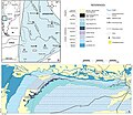
| current | 18:40, 21 February 2017 |  | 926 × 804 (232 KB) | FunkMonk | =={{int:filedesc}}== {{Information |description=Geological map showing the type locality of Isaberrysaura mollensis gen. et sp. nov. The map was made by Alberto C. Garrido on the basis of a LANDSAT satellite image available in the Dirección Provincial... |
File usage
The following 2 pages use this file:
Global file usage
The following other wikis use this file:
- Usage on es.wikipedia.org
- Usage on it.wikipedia.org
- Usage on nl.wikipedia.org
- Usage on www.wikidata.org
- Usage on zh.wikipedia.org
