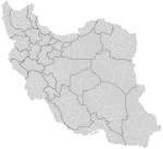
File:Iran counties.png
Appearance

Size of this preview: 800 × 548 pixels. Other resolutions: 320 × 219 pixels | 640 × 439 pixels | 1,024 × 702 pixels | 1,281 × 878 pixels.
Original file (1,281 × 878 pixels, file size: 66 KB, MIME type: image/png)
File history
Click on a date/time to view the file as it appeared at that time.
| Date/Time | Thumbnail | Dimensions | User | Comment | |
|---|---|---|---|---|---|
| current | 18:41, 4 November 2019 |  | 1,281 × 878 (66 KB) | BasilLeaf | 7 new counties in Fars: Bakhtegan, Beyza, Evaz, Khafr, Kuh Chenar, Sar chahan, Zarqan |
| 07:55, 19 April 2014 |  | 1,281 × 878 (62 KB) | Haghal Jagul | بروزرسانی کلی | |
| 10:55, 23 June 2013 |  | 1,281 × 878 (66 KB) | BasilLeaf | بروزرسانی کلی | |
| 23:54, 8 June 2013 |  | 1,281 × 878 (68 KB) | BasilLeaf | Design changed | |
| 23:35, 9 January 2011 |  | 1,281 × 878 (83 KB) | BasilLeaf | Updated and provinces showed. | |
| 21:34, 1 May 2007 |  | 1,281 × 878 (35 KB) | Rarelibra | Map of the counties (shahrestanha) of Iran. Created by ~~~~ for public domain use, using MapInfo Professional v8.5 and various mapping resources. |
File usage
The following page uses this file:
Global file usage
The following other wikis use this file:
- Usage on fa.wikipedia.org
- Usage on incubator.wikimedia.org
- Usage on pnb.wikipedia.org
- برازجان
- شہرستان شہریار
- شہرستان رباط کریم
- شہرستان ورامین
- شہرستان اسلام شہر
- شہرستان رے
- شہرستان تہران
- شہرستان شیراز
- ورامین
- رے
- شہریار
- اسلام شہر
- شہرستان فیروزکوہ
- رباط کریم
- شہرستان دماوند
- شہرستان خلخال
- شہرستان بیلہ سوار
- شہرستان اردبیل
- شہرستان شیمیرانت
- شہرستان گرمی
- شہرستان کوثر
- شہرستان شہر قدس
- شہرستان پاک دشت
- شہرستان ملارد
- شہرستان یزد
- شہرستان قزوین
- شہرستان اراک
- شہرستان زاہدان
- شہرستان رشت
- شہرستان ہمدان
- شہرستان کرمان
- شہرستان ارومیہ
- شہرستان کرمانشاہ
- شہرستان قم
- شہرستان اہواز
- شہرستان تبریز
- شہرستان کرج
- شہرستان اصفہان
- شہرستان مشہد
- شہرستان نیر
- شہرستان پارس آباد
- شہرستان نمین
- شہرستان مشگین شہر
- فیروزکوہ (شہر)
- خلخال
View more global usage of this file.


