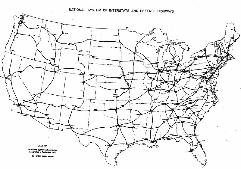
File:Interstate Highway plan September 1955.jpg
Appearance

Size of this preview: 800 × 564 pixels. Other resolutions: 320 × 226 pixels | 640 × 451 pixels | 1,024 × 722 pixels | 1,280 × 902 pixels | 1,799 × 1,268 pixels.
Original file (1,799 × 1,268 pixels, file size: 123 KB, MIME type: image/jpeg)
File history
Click on a date/time to view the file as it appeared at that time.
| Date/Time | Thumbnail | Dimensions | User | Comment | |
|---|---|---|---|---|---|
| current | 05:54, 25 December 2005 |  | 1,799 × 1,268 (123 KB) | SPUI~commonswiki | {{PD-USGov}} October 1957 map of the Interstate Highway System, from [http://www.kurumi.com/roads/3di/pics/map-isr-sep55.jpg]. Map 19571000 Category:road maps |
File usage
The following 4 pages use this file:
Global file usage
The following other wikis use this file:
- Usage on fr.wikipedia.org
- Usage on pl.wikipedia.org
- Usage on pt.wikipedia.org
- Usage on vi.wikipedia.org


