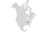
File:Interior Low Plateaus.png
Appearance

Size of this preview: 800 × 595 pixels. Other resolutions: 320 × 238 pixels | 640 × 476 pixels | 1,024 × 762 pixels | 1,151 × 856 pixels.
Original file (1,151 × 856 pixels, file size: 110 KB, MIME type: image/png)
File history
Click on a date/time to view the file as it appeared at that time.
| Date/Time | Thumbnail | Dimensions | User | Comment | |
|---|---|---|---|---|---|
| current | 04:44, 5 February 2017 |  | 1,151 × 856 (110 KB) | Masebrock | zoomed into area of interest |
| 21:44, 4 February 2017 |  | 2,253 × 1,992 (287 KB) | Masebrock | {{Information |Description={{en|1=Map of the Interior Low Plateaus. Based on the EPA Level III Ecoregion}} |Source={{own}} |Date=2017-02-4 |Masebrock) |Permission=No copyright |other_versio... |
File usage
The following page uses this file:
Global file usage
The following other wikis use this file:
- Usage on es.wikipedia.org
- Usage on www.wikidata.org
