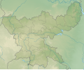
File:India Jharkhand relief map.svg
Appearance

Size of this PNG preview of this SVG file: 800 × 596 pixels. Other resolutions: 320 × 238 pixels | 640 × 476 pixels | 1,024 × 762 pixels | 1,280 × 953 pixels | 2,560 × 1,906 pixels | 1,162 × 865 pixels.
Original file (SVG file, nominally 1,162 × 865 pixels, file size: 2.26 MB)
File history
Click on a date/time to view the file as it appeared at that time.
| Date/Time | Thumbnail | Dimensions | User | Comment | |
|---|---|---|---|---|---|
| current | 18:24, 14 March 2023 |  | 1,162 × 865 (2.26 MB) | C1MM | Corrected borders |
| 04:09, 21 May 2021 |  | 848 × 631 (1.97 MB) | C1MM | Added better elevation colouring | |
| 21:00, 16 December 2020 |  | 829 × 617 (4.43 MB) | C1MM | Fixed elevation colours | |
| 06:05, 28 November 2020 |  | 829 × 617 (3.23 MB) | C1MM | Updated map of districts | |
| 00:31, 30 June 2020 |  | 856 × 714 (3.05 MB) | C1MM | Fixed relief map | |
| 05:51, 25 April 2020 |  | 856 × 714 (1.18 MB) | C1MM | Uploaded a work by Milenioscuro from Jharkhand_locator_map.svg with UploadWizard |
File usage
The following 31 pages use this file:
- Amanat River
- Auranga River (Jharkhand)
- Betla National Park
- Chakulia Airport
- Chandil Dam
- Charowa dam
- Dhalbhumgarh Airport
- Dhanbad Airport
- Dimna Lake
- Dumka Airport
- Getalsud Dam
- Jonha Falls
- Khukhragarh
- Konar Dam
- Lodh Falls
- Massanjore Dam
- Nawadih Airfield
- Panchet Dam
- Panchghagh Falls
- Parasnath
- Perwaghagh Falls
- Rajrappa
- Sadni Falls
- Saridkel
- Sita Falls
- Tenughat Dam
- Tilaiya Dam
- Usri Falls
- Module:Location map/data/India Jharkhand
- Module:Location map/data/India Jharkhand/doc
- Module:Location map/data/India Jharkhand/sandbox
Global file usage
The following other wikis use this file:
- Usage on anp.wikipedia.org
- Usage on bn.wikipedia.org
- Usage on ca.wikipedia.org
- Usage on es.wikipedia.org
- Usage on hi.wikipedia.org
- Usage on or.wikipedia.org
- Usage on pa.wikipedia.org
- Usage on si.wikipedia.org
- Usage on ta.wikipedia.org
- Usage on uk.wikipedia.org
