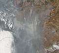
File:Imagem de satélite dos incêndios no Pantanal em 2020.jpg
Appearance

Size of this preview: 660 × 599 pixels. Other resolutions: 264 × 240 pixels | 529 × 480 pixels | 846 × 768 pixels | 1,128 × 1,024 pixels | 2,039 × 1,851 pixels.
Original file (2,039 × 1,851 pixels, file size: 346 KB, MIME type: image/jpeg)
File history
Click on a date/time to view the file as it appeared at that time.
| Date/Time | Thumbnail | Dimensions | User | Comment | |
|---|---|---|---|---|---|
| current | 19:37, 17 September 2020 |  | 2,039 × 1,851 (346 KB) | Themium | Uploaded a work by NOAA-20 / VIIRS from https://worldview.earthdata.nasa.gov/?v=-69.94006334356925,-23.472625122590642,-46.970150464271995,-12.214975112476722&t=2020-09-14-T18%3A59%3A00Z&l=Reference_Labels(hidden),Reference_Features,Coastlines,VIIRS_NOAA20_CorrectedReflectance_TrueColor,VIIRS_SNPP_CorrectedReflectance_TrueColor(hidden),MODIS_Aqua_CorrectedReflectance_TrueColor(hidden),MODIS_Terra_CorrectedReflectance_TrueColor(hidden) with UploadWizard |
File usage
The following 2 pages use this file:
Global file usage
The following other wikis use this file:
- Usage on gn.wikipedia.org
- Usage on pt.wikipedia.org
- Usage on www.wikidata.org


