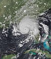
File:Idalia 2023-08-30 0715Z (Nighttime Visible Imagery).jpg
Appearance

Size of this preview: 475 × 599 pixels. Other resolutions: 190 × 240 pixels | 381 × 480 pixels | 609 × 768 pixels | 812 × 1,024 pixels | 2,300 × 2,900 pixels.
Original file (2,300 × 2,900 pixels, file size: 7.21 MB, MIME type: image/jpeg)
File history
Click on a date/time to view the file as it appeared at that time.
| Date/Time | Thumbnail | Dimensions | User | Comment | |
|---|---|---|---|---|---|
| current | 22:41, 2 September 2023 |  | 2,300 × 2,900 (7.21 MB) | FooBarBaz | Trying to make it a bit narrow so it doesn't look bad. |
| 21:50, 2 September 2023 |  | 2,500 × 2,900 (7.75 MB) | FooBarBaz | Cropping image so the eye is centered. | |
| 00:27, 1 September 2023 |  | 2,500 × 3,100 (8 MB) | TheWxResearcher | This image is the hardest image that I uploaded to Wiki Commons. This should suffice clouds not too bright the background also isn't as bright ._. . | |
| 00:07, 1 September 2023 |  | 2,500 × 3,100 (8.07 MB) | TheWxResearcher | cropped | |
| 20:40, 31 August 2023 |  | 2,900 × 3,500 (10.66 MB) | TheWxResearcher | m | |
| 19:00, 31 August 2023 |  | 2,900 × 3,500 (8.34 MB) | TheWxResearcher | Okay the land is not obsessively bright anymore looks more like a nighttime image | |
| 18:53, 31 August 2023 |  | 2,900 × 3,500 (8.69 MB) | TheWxResearcher | Tweaks with the brightness and tweaks to the land placement. | |
| 18:20, 31 August 2023 |  | 2,900 × 3,500 (8.75 MB) | TheWxResearcher | Uploaded a work by VIIRS imagery from NOAA's NOAA-20 Satellite from *[https://cimss.ssec.wisc.edu/ Cooperative Institute for Meteorological Satellite Studies] (Satellite Data) *[https://worldview.earthdata.nasa.gov/ EOSDIS Worldview] with UploadWizard |
File usage
The following page uses this file:
Global file usage
The following other wikis use this file:
- Usage on fr.wikipedia.org
- Usage on www.wikidata.org


