From Wikipedia, the free encyclopedia

No higher resolution available.
Summary
Licensing
| Public domainPublic domainfalsefalse
|
Original upload log
The original description page was
here. All following user names refer to en.wikipedia.
| Date/Time |
Dimensions |
User |
Comment
|
| 2004-09-06 00:09 |
422×359× (14473 bytes) |
Ke4roh |
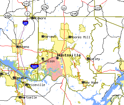
Tiger map [http://tiger.census.gov/cgi-bin/mapper/map.gif?&lat=34.74525&lon=-86.58983&ht=0.720&wid=0.720&&on=CITIES&on=places&on=railroad&off=streets&off=tracts&on=interstate&on=statehwy&off=street_names&tlevel=-&tvar=-&tmeth=i&mlat=&mlon=&msym=redpin&mla
|
Add a one-line explanation of what this file represents
File history
Click on a date/time to view the file as it appeared at that time.
| Date/Time | Thumbnail | Dimensions | User | Comment |
|---|
| current | 11:39, 6 March 2016 |  | 422 × 359 (14 KB) | FastilyClone | Transferred from enwp |
File usage
The following page uses this file:
This file contains additional information, probably added from the digital camera or scanner used to create or digitize it.
If the file has been modified from its original state, some details may not fully reflect the modified file.


