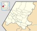
File:Huehuetenango department location map.svg
Appearance

Size of this PNG preview of this SVG file: 375 × 313 pixels. Other resolutions: 288 × 240 pixels | 575 × 480 pixels | 920 × 768 pixels | 1,227 × 1,024 pixels | 2,454 × 2,048 pixels.
Original file (SVG file, nominally 375 × 313 pixels, file size: 1.03 MB)
File history
Click on a date/time to view the file as it appeared at that time.
| Date/Time | Thumbnail | Dimensions | User | Comment | |
|---|---|---|---|---|---|
| current | 17:46, 17 May 2019 |  | 375 × 313 (1.03 MB) | Edgouno | User created page with UploadWizard |
File usage
The following 3 pages use this file:
Global file usage
The following other wikis use this file:
- Usage on es.wikipedia.org
- San Antonio Huista
- Santa Cruz Barillas
- Zaculeu
- Todos Santos Cuchumatán
- Laguna Brava (Guatemala)
- Jacaltenango
- Huehuetenango (municipio)
- Aguacatán
- Chiantla
- Colotenango
- Concepción Huista
- Cuilco
- La Democracia (Huehuetenango)
- La Libertad (Huehuetenango)
- Malacatancito
- Nentón
- Tectitán
- Unión Cantinil
- Santa Eulalia (Guatemala)
- Santiago Chimaltenango
- San Gaspar Ixchil
- San Ildefonso Ixtahuacán
- San Juan Atitán
- San Juan Ixcoy
- San Mateo Ixtatán
- San Miguel Acatán
- San Pedro Nécta
- San Pedro Soloma
- San Rafael La Independencia
- San Rafael Pétzal
- San Sebastián Coatán
- San Sebastián Huehuetenango
- Santa Ana Huista
- Santa Bárbara (Guatemala)
- Plantilla:Mapa de localización de Huehuetenango
- Petatán
- Nuevo León (Guatemala)
- Usage on fr.wikipedia.org
- Usage on si.wikipedia.org
- Usage on uz.wikipedia.org

