
File:HistoricalRailMapMexico.jpg

Size of this preview: 800 × 551 pixels. Other resolutions: 320 × 220 pixels | 640 × 440 pixels | 1,024 × 705 pixels | 1,280 × 881 pixels | 2,560 × 1,762 pixels | 4,730 × 3,255 pixels.
Original file (4,730 × 3,255 pixels, file size: 7.54 MB, MIME type: image/jpeg)
| This is a file from the Wikimedia Commons. Information from its description page there is shown below. Commons is a freely licensed media file repository. You can help. |
Summary
| Description |
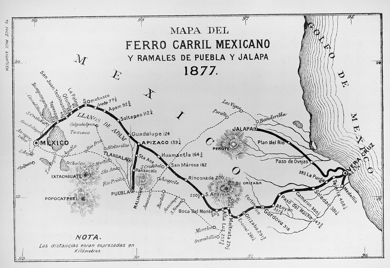
English: Print shows map of a railway line from Mexico City to Veracruz, Mexico, with additional lines between Apizaco and Puebla and between Jalapa and Veracruz; also includes locations of volcanoes. |
| Date | |
| Source | H.C.R. Becher, A trip to Mexico : being notes of a journey from Lake Erie to Lake Tezcuco and back |
| Author | H.C.R. Becher |
Licensing
This media file is in the public domain in the United States. This applies to U.S. works where the copyright has expired, often because its first publication occurred prior to January 1, 1929, and if not then due to lack of notice or renewal. See this page for further explanation.
|
 | |
 |
File history
Click on a date/time to view the file as it appeared at that time.
| Date/Time | Thumbnail | Dimensions | User | Comment | |
|---|---|---|---|---|---|
| current | 06:20, 23 May 2013 | | 4,730 × 3,255 (7.54 MB) | Cesarth15 | Higher resolution |
| 18:33, 21 August 2008 |  | 593 × 394 (99 KB) | Arturoramos | {{Information |Description={{en|1=Print shows map of a railway line from Mexico City to Veracruz, Mexico, with additional lines between Apizaco and Puebla and between Jalapa and Veracruz; also includes locations of volcanoes.}} |Source=H.C.R. Becher, A tr |
File usage
The following 4 pages use this file:
Global file usage
The following other wikis use this file:
- Usage on es.wikipedia.org
- Usage on ru.wikipedia.org