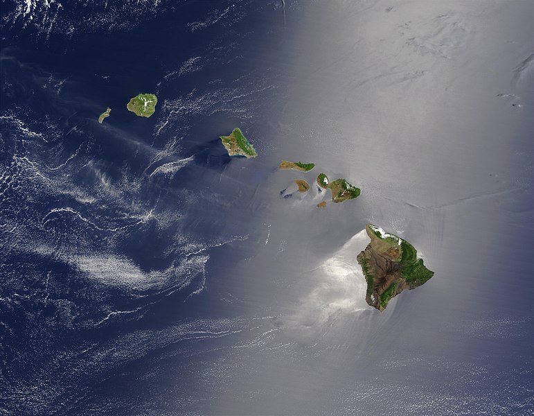
File:Hawaje-NoRedLine.jpg
Appearance

Size of this preview: 771 × 600 pixels. Other resolutions: 309 × 240 pixels | 617 × 480 pixels | 988 × 768 pixels | 1,280 × 996 pixels | 2,560 × 1,991 pixels | 3,600 × 2,800 pixels.
Original file (3,600 × 2,800 pixels, file size: 2.81 MB, MIME type: image/jpeg)
| This is a featured picture, which means that members of the community have identified it as one of the finest images on the English Wikipedia, adding significantly to its accompanying article. If you have a different image of similar quality, be sure to upload it using the proper free license tag, add it to a relevant article, and nominate it. |
| This image was selected as picture of the day on the English Wikipedia for August 21, 2011. |
File history
Click on a date/time to view the file as it appeared at that time.
| Date/Time | Thumbnail | Dimensions | User | Comment | |
|---|---|---|---|---|---|
| current | 22:24, 1 September 2010 |  | 3,600 × 2,800 (2.81 MB) | IdLoveOne~commonswiki | {{RetouchedPicture|cloned out and healed little red line on the big island|editor=IdLoveOne|orig=Hawaje.jpg}} {{self|PD-USGov-NASA}} == {{Original upload log}} == This image is a derivative work of the following images: *File:Hawaje.jpg licensed w |
File usage
The following 32 pages use this file:
- Cladogenesis
- Climate of Hawaii
- Hawaiian Islands
- Island
- Marcia McNutt
- Megalagrion xanthomelas
- Sunglint
- Talk:Hawaiian Islands
- User:Jane023/Biosphere reserves
- User:Jrovc/sandbox
- User:Kerowyn
- User:Public Juju/FP
- User:VGrigas (WMF)/Quality Media
- User:Va1tz7/sandbox
- User:Xophist/s8
- User talk:Cowtowner
- User talk:IdLoveOne/Archive 1
- Wikipedia:Featured picture candidates/Hawaii
- Wikipedia:Featured picture candidates/September-2010
- Wikipedia:Featured pictures/Space/Looking back
- Wikipedia:Featured pictures thumbs/25
- Wikipedia:Main Page history/2011 August 21
- Wikipedia:Main Page history/2016 January 18
- Wikipedia:Picture of the day/August 2011
- Wikipedia:Selected anniversaries/January 18
- Wikipedia:WikiProject Volcanoes/Content
- Template:POTD/2011-08-21
- Portal:Islands/Selected article
- Portal:Islands/Selected article/37
- Portal:Islands/Selected picture
- Portal:Islands/Selected picture/4
- Portal:Oceans
Global file usage
The following other wikis use this file:
- Usage on ace.wikipedia.org
- Usage on af.wikipedia.org
- Usage on als.wikipedia.org
- Usage on ar.wikipedia.org
- Usage on ary.wikipedia.org
- Usage on arz.wikipedia.org
- Usage on ast.wikipedia.org
- Usage on azb.wikipedia.org
- Usage on az.wikipedia.org
- Usage on ba.wikipedia.org
- Usage on be-tarask.wikipedia.org
- Usage on be.wikipedia.org
- Usage on bh.wikipedia.org
- Usage on bn.wikipedia.org
- Usage on bn.wikibooks.org
- Usage on bn.wikivoyage.org
- Usage on ca.wikipedia.org
- Usage on ceb.wikipedia.org
- Usage on crh.wikipedia.org
- Usage on cs.wikipedia.org
- Usage on cv.wikipedia.org
- Usage on cy.wikipedia.org
- Usage on dag.wikipedia.org
- Usage on de.wikipedia.org
- Usage on diq.wikipedia.org
- Usage on el.wikipedia.org
- Usage on en.wikibooks.org
- Usage on en.wikivoyage.org
- Usage on eo.wikipedia.org
- Usage on eo.wikiquote.org
View more global usage of this file.


