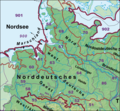
File:Haupteinheitengruppen Tiefland Westteil.png
Appearance

Size of this preview: 647 × 599 pixels. Other resolutions: 259 × 240 pixels | 518 × 480 pixels | 1,000 × 926 pixels.
Original file (1,000 × 926 pixels, file size: 1.22 MB, MIME type: image/png)
File history
Click on a date/time to view the file as it appeared at that time.
| Date/Time | Thumbnail | Dimensions | User | Comment | |
|---|---|---|---|---|---|
| current | 18:55, 23 December 2020 |  | 1,000 × 926 (1.22 MB) | Elop | |
| 23:20, 25 December 2014 |  | 1,000 × 926 (1.19 MB) | Elop | war falscher Ausschnitt | |
| 19:01, 25 December 2014 |  | 1,000 × 926 (1.14 MB) | Elop | update | |
| 13:49, 22 November 2014 |  | 1,000 × 924 (1,009 KB) | Elop | update | |
| 15:34, 1 July 2012 |  | 1,000 × 924 (1.07 MB) | Elop | update | |
| 00:32, 25 October 2011 |  | 1,000 × 896 (2.57 MB) | Elop | k | |
| 16:28, 24 October 2011 |  | 1,000 × 889 (2.55 MB) | Elop | Grenzkorrektur Weser/Aller | |
| 15:25, 24 October 2011 |  | 1,000 × 876 (2.51 MB) | Elop | smaller | |
| 12:48, 24 October 2011 |  | 1,000 × 1,289 (3.7 MB) | Elop | more details | |
| 14:25, 2 October 2011 |  | 913 × 999 (2.61 MB) | Elop | == {{int:filedesc}} == {{Information |Description={{de|1=Haupteinheitengruppen im Westen des Norddeutschen Tieflandes nebst Lössbörden}} |Source=*[[:Image:Deutschland_Naturräumliche Haupteinheiten.png|Deutschland_Naturräumli |
File usage
The following page uses this file:
Global file usage
The following other wikis use this file:
- Usage on cs.wikipedia.org
- Usage on de.wikipedia.org
- Norddeutsches Tiefland
- Naturräumliche Großregionen Deutschlands
- Dümmer-Geestniederung
- Ostfriesisch-Oldenburgische Geest
- Hohe Heide
- Südheide
- Luheheide
- Benutzer:Aeroid/List DE NI-WL
- Benutzer:Aeroid/Geo North European Plain
- Benutzer:Aeroid/Natural region DE 64
- Benutzer:Aeroid/List DE NI Natural region
- Benutzer:Aeroid/List DE HH-unmittelbar
- Usage on nds.wikipedia.org
- Usage on www.wikidata.org

