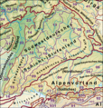
File:Haupteinheitengruppen Suedwestdeutsches Stufenland.png
Appearance

Size of this preview: 572 × 599 pixels. Other resolutions: 229 × 240 pixels | 458 × 480 pixels | 1,000 × 1,048 pixels.
Original file (1,000 × 1,048 pixels, file size: 1.89 MB, MIME type: image/png)
File history
Click on a date/time to view the file as it appeared at that time.
| Date/Time | Thumbnail | Dimensions | User | Comment | |
|---|---|---|---|---|---|
| current | 19:07, 23 December 2020 |  | 1,000 × 1,048 (1.89 MB) | Elop | |
| 19:29, 25 December 2014 |  | 1,000 × 1,048 (1.87 MB) | Elop | update | |
| 13:55, 2 July 2012 |  | 1,000 × 1,047 (1.72 MB) | Elop | k | |
| 21:46, 1 July 2012 |  | 1,000 × 1,051 (1.73 MB) | Elop | k | |
| 16:29, 1 July 2012 |  | 1,000 × 1,048 (1.72 MB) | Elop | update | |
| 15:00, 27 May 2012 |  | 1,000 × 1,067 (1.75 MB) | Elop | ||
| 00:45, 25 October 2011 |  | 1,000 × 1,067 (3.06 MB) | Elop | k | |
| 13:03, 24 October 2011 |  | 1,000 × 1,044 (2.99 MB) | Elop | more details | |
| 14:07, 2 October 2011 |  | 913 × 956 (2.5 MB) | Elop | == {{int:filedesc}} == {{Information |Description={{de|1=de:Oberrheinisches Tiefland und Haupteinheitengruppen des Südwestdeutschen Stufenlandes}} |Source=*[[:Image:Deutschland_Naturräumliche Haupteinheiten.png |
File usage
The following page uses this file:
Global file usage
The following other wikis use this file:
- Usage on bg.wikipedia.org
- Usage on de.wikipedia.org
- Schwäbische Alb
- Fränkische Alb
- Südwestdeutsches Stufenland
- Naturräumliche Großregionen Deutschlands
- Diskussion:Jagst/Archiv
- Mainfränkische Platten
- Schwäbisches Keuper-Lias-Land
- Fränkisches Keuper-Lias-Land
- Benutzer:Frze
- Naturräumliche Gliederung der Fränkischen Alb
- Naturräumliche Gliederung der Schwäbischen Alb
- Vorlage:Positionskarte Deutschland Naturraum Südwestdeutsches Stufenland
- Vorlage Diskussion:Positionskarte Deutschland Naturraum Südwestdeutsches Stufenland
- Benutzer Diskussion:Alburlaub
- Usage on fr.wikipedia.org
- Usage on la.wikipedia.org
- Usage on pl.wikipedia.org


