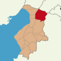
File:Hatay location Hassa.png
Appearance
Hatay_location_Hassa.png (600 × 600 pixels, file size: 32 KB, MIME type: image/png)
File history
Click on a date/time to view the file as it appeared at that time.
| Date/Time | Thumbnail | Dimensions | User | Comment | |
|---|---|---|---|---|---|
| current | 18:14, 25 January 2024 |  | 600 × 600 (32 KB) | Matrix | Reverted to version as of 16:39, 24 January 2024 (UTC) |
| 17:46, 24 January 2024 |  | 600 × 600 (89 KB) | 7p-9 | Reverted to version as of 21:36, 20 January 2024 (UTC) | |
| 16:39, 24 January 2024 |  | 600 × 600 (32 KB) | Matrix | Reverted to version as of 06:51, 19 January 2024 (UTC) | |
| 21:36, 20 January 2024 |  | 600 × 600 (89 KB) | Ob9u | Reverted to version as of 04:03, 15 January 2024 (UTC) | |
| 06:51, 19 January 2024 |  | 600 × 600 (32 KB) | Aintabli | rv sokc | |
| 04:03, 15 January 2024 |  | 600 × 600 (89 KB) | GER212 | Reverted to version as of 06:32, 1 January 2024 (UTC) | |
| 17:40, 13 January 2024 |  | 600 × 600 (32 KB) | Aintabli | Reverted to version as of 14:16, 17 July 2016 (UTC) It turns out TCfanssos, who was behind the previous version, was a sock. In any case, seek consensus first. Other provincial maps of Turkey are in this style. We’re not going to change one province and leave the rest. | |
| 06:32, 1 January 2024 |  | 600 × 600 (89 KB) | Hatayjjv | Reverted to version as of 02:24, 22 September 2023 (UTC) | |
| 16:38, 1 October 2023 |  | 600 × 600 (32 KB) | Aintabli | Reverted to version as of 14:16, 17 July 2016 (UTC) unexplained change; first version looks much better imo | |
| 02:24, 22 September 2023 |  | 600 × 600 (89 KB) | TCfanssos | update |
File usage
The following page uses this file:
Global file usage
The following other wikis use this file:
- Usage on en.wiktionary.org

