
File:Hamburg-Gueterumgehungsbahn-Karte-2010.jpg
Size of this preview: 800 × 559 pixels. Other resolutions: 320 × 224 pixels | 640 × 448 pixels | 1,024 × 716 pixels | 1,194 × 835 pixels.
Original file (1,194 × 835 pixels, file size: 367 KB, MIME type: image/jpeg)
| This is a file from the Wikimedia Commons. Information from its description page there is shown below. Commons is a freely licensed media file repository. You can help. |
Summary
| Description |
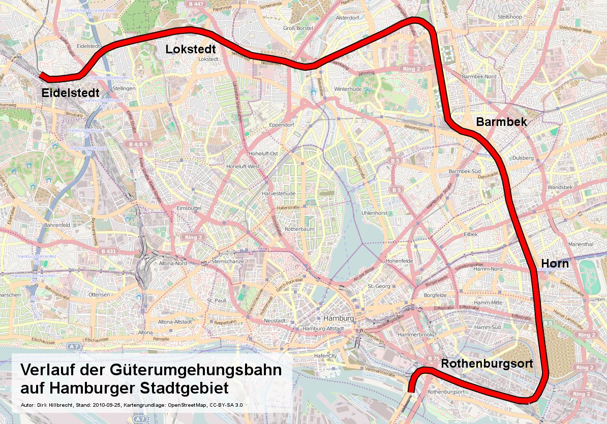
English: Map of Hamburg freight bypass railroad in the city area between Eidelstedt and Veddel
Deutsch: Verlauf der Güterumgehungsbahn Hamburg zwischen Eidelstedt und Veddel |
| Date | |
| Source | Own work based on OpenStreetMap |
| Author | Dirkhillbrecht |
| Other versions |
|

Licensing
I, the copyright holder of this work, hereby publish it under the following license:
This file is licensed under the Creative Commons Attribution-Share Alike 3.0 Unported license.
- You are free:
- to share – to copy, distribute and transmit the work
- to remix – to adapt the work
- Under the following conditions:
- attribution – You must give appropriate credit, provide a link to the license, and indicate if changes were made. You may do so in any reasonable manner, but not in any way that suggests the licensor endorses you or your use.
- share alike – If you remix, transform, or build upon the material, you must distribute your contributions under the same or compatible license as the original.
File history
Click on a date/time to view the file as it appeared at that time.
| Date/Time | Thumbnail | Dimensions | User | Comment | |
|---|---|---|---|---|---|
| current | 16:51, 25 September 2010 | | 1,194 × 835 (367 KB) | Dirkhillbrecht~commonswiki | {{Information |Description={{en|1=Map of Hamburg freight bypass railroad in the city area between Eidelstedt and Veddel}} {{de|1=Verlauf der Güterumgehungsbahn Hamburg zwischen Eidelstedt und Veddel}} |Source={{own}} based on OpenStreetMap |Author=[[User |
File usage
The following page uses this file:
Global file usage
The following other wikis use this file:
- Usage on de.wikipedia.org
- Usage on www.wikidata.org