Jump to content

File:Gwash map02.jpg

Page contents not supported in other languages.
This is a file from the Wikimedia Commons
From Wikipedia, the free encyclopedia

Original file (3,227 × 2,390 pixels, file size: 1.77 MB, MIME type: image/jpeg)

Summary

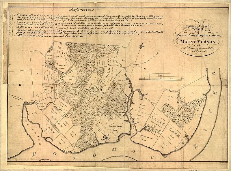
Map of Mount Vernon, residence of George Washington made by himself.

A map of General Washington's farm of Mount Vernon from a drawing transmitted by the General.

Uploaded from http://hdl.loc.gov/loc.gmd/g3882m.ct000367.


Notes from Library of Congress page:

CREATED/PUBLISHED [S.l., 1801]

NOTES Removed from: Letters from His Excellency George Washington, to Arthur Young, [etc.]. London, 1801. Opp. p. (E312.75.A27 Rare Book Rm.)

Scale 1:6,336.

SUBJECTS Mount Vernon (Va. : Estate)--Maps--Early works to 1800. United States--Virginia--Mount Vernon (Estate)

MEDIUM 1 map ; 37 x 52 cm.

CALL NUMBER G3882.M7 1793 .W34 1801 TIL Vault

REPOSITORY Library of Congress Geography and Map Division Washington, D.C. 20540-4650

DIGITAL ID g3882m ct000367


This map is available from the United States Library of Congress's Geography & Map Division
under the digital ID g3882m.ct000367.
This tag does not indicate the copyright status of the attached work. A normal copyright tag is still required. See Commons:Licensing.

العربية  беларуская (тарашкевіца)  বাংলা  čeština  Deutsch  English  español  فارسی  suomi  français  galego  עברית  magyar  Bahasa Indonesia  italiano  日本語  lietuvių  македонски  മലയാളം  Nederlands  polski  português  português do Brasil  română  русский  sicilianu  slovenčina  slovenščina  Türkçe  українська  中文  中文(简体)  中文(繁體)  +/−

Licensing

Public domain

This work is in the public domain in its country of origin and other countries and areas where the copyright term is the author's life plus 70 years or fewer.


You must also include a United States public domain tag to indicate why this work is in the public domain in the United States.
This file has been identified as being free of known restrictions under copyright law, including all related and neighboring rights.

File history

Click on a date/time to view the file as it appeared at that time.

Date/TimeThumbnailDimensionsUserComment
current02:17, 1 October 2006Thumbnail for version as of 02:17, 1 October 20063,227 × 2,390 (1.77 MB)ClindbergReupload from http://hdl.loc.gov/loc.gmd/g3882m.ct000367 with higher resolution; change license (not USGov but is PD-old)
13:01, 6 June 2005Thumbnail for version as of 13:01, 6 June 2005804 × 600 (138 KB)Herrick~commonswikiMap of Mount Vernon, residence of George Washington made by himself. A map of General Washington's farm of Mount Vernon from a drawing transmitted by the General. {{PD-USGov}} Washington, George, 1732-1799. CREATED/PUBLISHED [S.l., 1801] NOTES

The following 4 pages use this file:

Global file usage

The following other wikis use this file:

Metadata