
File:Grundy Virginia flood 1984.jpg

Size of this preview: 800 × 546 pixels. Other resolutions: 320 × 218 pixels | 640 × 436 pixels | 1,024 × 698 pixels | 1,500 × 1,023 pixels.
Original file (1,500 × 1,023 pixels, file size: 514 KB, MIME type: image/jpeg)
| This is a file from the Wikimedia Commons. Information from its description page there is shown below. Commons is a freely licensed media file repository. You can help. |
| Description |
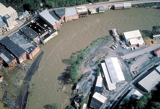
English: Aerial view of flooding on the Levisa Fork River in Grundy, Virginia, USA, in 1984. The town of Grundy, the State of Virginia, and the U.S. Army Corps of Engineers are cooperating in a project to relocate the business center of the town away from the flood-prone areas along the river. |
|||
| Date | ||||
| Source |
U.S. Army Corps of Engineers Digital Visual Library Image page Image description page Digital Visual Library home page |
|||
| Author | U.S. Army Corps of Engineers, photographer not specified or unknown | |||
| Permission (Reusing this file) |
|
|||
| Location | Grundy, Virginia, USA |
| Camera location | | View this and other nearby images on: OpenStreetMap |
|---|
File history
Click on a date/time to view the file as it appeared at that time.
| Date/Time | Thumbnail | Dimensions | User | Comment | |
|---|---|---|---|---|---|
| current | 03:46, 31 March 2007 | | 1,500 × 1,023 (514 KB) | DanMS | {{Information | Description = {{en|Aerial view of flooding on the Levisa Fork River in Grundy, Virginia, USA, in 1984. The town of Grundy, the State of Virginia, and the U.S. Army Corps of Engineers are cooperating in a project to relocate the business |
File usage
The following page uses this file:
Global file usage
The following other wikis use this file:
- Usage on ast.wikipedia.org
- Usage on de.wikipedia.org
- Usage on fr.wikipedia.org