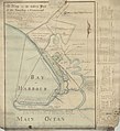
File:Gravesend 1788.jpg
Appearance

Size of this preview: 547 × 600 pixels. Other resolutions: 219 × 240 pixels | 438 × 480 pixels | 701 × 768 pixels | 934 × 1,024 pixels | 1,868 × 2,048 pixels | 3,245 × 3,557 pixels.
Original file (3,245 × 3,557 pixels, file size: 9.26 MB, MIME type: image/jpeg)
File history
Click on a date/time to view the file as it appeared at that time.
| Date/Time | Thumbnail | Dimensions | User | Comment | |
|---|---|---|---|---|---|
| current | 03:26, 19 February 2023 |  | 3,245 × 3,557 (9.26 MB) | Pharos | Uploaded a work by Herman Lefford & Roger Strong from https://mapcollections.brooklynhistory.org/map/map-of-the-western-part-of-the-township-of-gravesend-originally-laid-down-by-a-scale-of-five-chains-or-20-rods-to-an-inch-8th-august-1788-by-herman-lefford-roger-strong-april-16th-1806/ with UploadWizard |
File usage
The following page uses this file:
