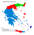
File:Gr-triple-occupation.png
Appearance

Size of this preview: 588 × 600 pixels. Other resolutions: 235 × 240 pixels | 471 × 480 pixels | 899 × 917 pixels.
Original file (899 × 917 pixels, file size: 82 KB, MIME type: image/png)
File history
Click on a date/time to view the file as it appeared at that time.
| Date/Time | Thumbnail | Dimensions | User | Comment | |
|---|---|---|---|---|---|
| current | 15:48, 22 May 2006 |  | 899 × 917 (82 KB) | GhePeU | slightly reworked image |
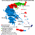
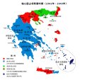
| 16:06, 2 July 2005 |  | 899 × 917 (107 KB) | Michalis Famelis | Map showning the zones of control of the three occupying powers in Greece during WW2, from 1941 to 1944. The image was created by me using another map as a template. This image was created using the Gimp. {{GFDL}} |
File usage
The following 2 pages use this file:
Global file usage
The following other wikis use this file:
- Usage on ca.wikipedia.org
- Usage on de.wikipedia.org
- Usage on hu.wikipedia.org
- Usage on ku.wikipedia.org
- Usage on lv.wikipedia.org
- Usage on ro.wikipedia.org
- Usage on sv.wikipedia.org
- Usage on tr.wikipedia.org
- Usage on zh.wikipedia.org


