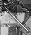
File:Goodland Municipal Airport-KS-28Aug1991-USGS.jpg
Appearance

Size of this preview: 530 × 599 pixels. Other resolutions: 212 × 240 pixels | 424 × 480 pixels | 803 × 908 pixels.
Original file (803 × 908 pixels, file size: 178 KB, MIME type: image/jpeg)
File history
Click on a date/time to view the file as it appeared at that time.
| Date/Time | Thumbnail | Dimensions | User | Comment | |
|---|---|---|---|---|---|
| current | 23:38, 4 March 2010 |  | 803 × 908 (178 KB) | Bwmoll3 | {{Information |Description={{en|1=Renner Field (Goodland Municipal Airport), Goodland, Kansas, USA}} |Source=US Geological Survey http://msrmaps.com/map.aspx?t=1&s=11&lon=-101.698889&lat=39.370556&w=1000&h=1000&opt=0&f=Tahoma,Verdana,Arial&fs=8&fc=ffffff9 |
File usage
The following page uses this file:
Global file usage
The following other wikis use this file:
- Usage on arz.wikipedia.org
- Usage on ceb.wikipedia.org
- Usage on en.wikivoyage.org
- Usage on fa.wikipedia.org
- Usage on ro.wikipedia.org
- Usage on tg.wikipedia.org
- Usage on ur.wikipedia.org
- Usage on www.wikidata.org

