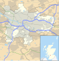
File:Glasgow UK location map.svg
Appearance

Size of this PNG preview of this SVG file: 588 × 600 pixels. Other resolutions: 235 × 240 pixels | 471 × 480 pixels | 753 × 768 pixels | 1,004 × 1,024 pixels | 2,008 × 2,048 pixels | 1,357 × 1,384 pixels.
Original file (SVG file, nominally 1,357 × 1,384 pixels, file size: 1,006 KB)
File history
Click on a date/time to view the file as it appeared at that time.
| Date/Time | Thumbnail | Dimensions | User | Comment | |
|---|---|---|---|---|---|
| current | 17:24, 6 February 2012 |  | 1,357 × 1,384 (1,006 KB) | Jheald | Updated for M80 and M74 (hand-edited in with Inkscape, tracing a screengrab from OpenStreetmap). |
| 20:15, 26 September 2010 |  | 1,357 × 1,384 (1,002 KB) | Nilfanion | {{Information |Description=Blank map of Glasgow, UK with the following information shown: *Administrative borders *Coastline, lakes and rivers *Roads and railways *Urban areas Equirectangular map projection on WGS 84 datum, with N/S stretch |
File usage
More than 100 pages use this file. The following list shows the first 100 pages that use this file only. A full list is available.
- Anderston
- Anniesland
- Arden, Glasgow
- Auchenshuggle
- Baillieston
- Balornock
- Bargeddie
- Barlanark
- Barmulloch
- Barrhead
- Bearsden
- Bellahouston
- Bishopbriggs
- Blairdardie
- Bridgeton, Glasgow
- Broomhill, Glasgow
- Burrell Collection
- Calton, Glasgow
- Cambuslang
- Cardonald
- Carmunnock
- Carmyle
- Carntyne
- Castlemilk
- Cathcart
- Cathkin Park
- Celtic Park
- Clydebank
- Colston, Glasgow
- Cowcaddens
- Cowlairs
- Craigend, Glasgow
- Craigton, Glasgow
- Cranhill
- Croftfoot
- Crookston, Glasgow
- Crossmyloof
- Dalmarnock
- Darnley
- Dawsholm Park
- Dennistoun
- Dowanhill
- Drumchapel
- Eaglesham
- Easterhouse
- Faifley
- Finnieston
- Firhill Stadium
- Garnethill
- Garrowhill
- Garscadden
- Garthamlock
- Germiston, Glasgow
- Giffnock
- Gorbals
- Govan
- Greenfield, Glasgow
- Halfway, Glasgow
- Hampden Park
- Hardgate
- Hillhead
- Hillington, Scotland
- Hyndland
- Ibrox, Glasgow
- Ibrox Stadium
- Jordanhill
- Kelvinbridge
- Kelvindale
- Kirkintilloch
- Knightswood
- Lenzie
- Maryhill
- Mount Florida
- Mount Vernon, Glasgow
- Netherlee
- Newton Mearns
- Nitshill
- North Kelvinside
- Old Firm
- Parkhead
- Partick
- Penilee
- Pollok
- Pollokshaws
- Pollokshields
- Ralston, Renfrewshire
- Riddrie
- Robroyston
- Rutherglen
- Scotstoun
- Shettleston
- Southpark Village
- Springburn
- Strathbungo
- Summerston
- Temple, Glasgow
- Thornliebank
- Tollcross, Glasgow
- Toryglen
- Townhead
View more links to this file.
Global file usage
The following other wikis use this file:
- Usage on ar.wikipedia.org
- Usage on azb.wikipedia.org
- Usage on az.wikipedia.org
- Usage on ban.wikipedia.org
- Usage on bg.wikipedia.org
- Usage on ceb.wikipedia.org
- Usage on de.wikipedia.org
- Ibrox Stadium
- Hampden Park
- Celtic Park
- Hamilton Crescent
- Firhill Stadium
- Emirates Arena
- Ibrox Park
- OVO Hydro
- Vorlage:Positionskarte Schottland Glasgow
- Scotstoun Stadium
- Glasgow City Heliport
- Springvale Park
- Cathkin Park (1872)
- Hampden Park (1873)
- Cathkin Park (1884)
- Barrowfield Park
- Hyde Park (Glasgow)
- Braehead Park
- Lesser Hampden
- Meadowside
- Inchview
- Jordanvale Park
- Usage on es.wikipedia.org
- Usage on eu.wikipedia.org
- Usage on fa.wikipedia.org
- Usage on fr.wikipedia.org
View more global usage of this file.
