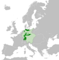
File:German Empire (1849).png
Appearance

Size of this preview: 592 × 600 pixels. Other resolutions: 237 × 240 pixels | 474 × 480 pixels | 758 × 768 pixels | 1,010 × 1,024 pixels | 2,021 × 2,048 pixels.
Original file (2,021 × 2,048 pixels, file size: 459 KB, MIME type: image/png)
File history
Click on a date/time to view the file as it appeared at that time.
| Date/Time | Thumbnail | Dimensions | User | Comment | |
|---|---|---|---|---|---|
| current | 05:13, 4 March 2024 |  | 2,021 × 2,048 (459 KB) | Arrokoth486958 | Fixed palatinate as part of bavaria. Also changed map from 1815 to 1849 to make more accurate |
| 11:23, 6 May 2021 |  | 2,560 × 2,594 (583 KB) | Arrokoth486958 | Uploaded a work by Alphathon from https://commons.wikimedia.org/wiki/File:Blank_map_of_Europe.svg with UploadWizard |
File usage
The following 2 pages use this file:
Global file usage
The following other wikis use this file:
- Usage on ar.wikipedia.org
- Usage on cs.wikipedia.org
- Usage on es.wikipedia.org
- Usage on he.wikipedia.org
- Usage on it.wikipedia.org
- Usage on ja.wikipedia.org
- Usage on pt.wikipedia.org
- Usage on th.wikipedia.org
- Usage on uk.wikipedia.org
